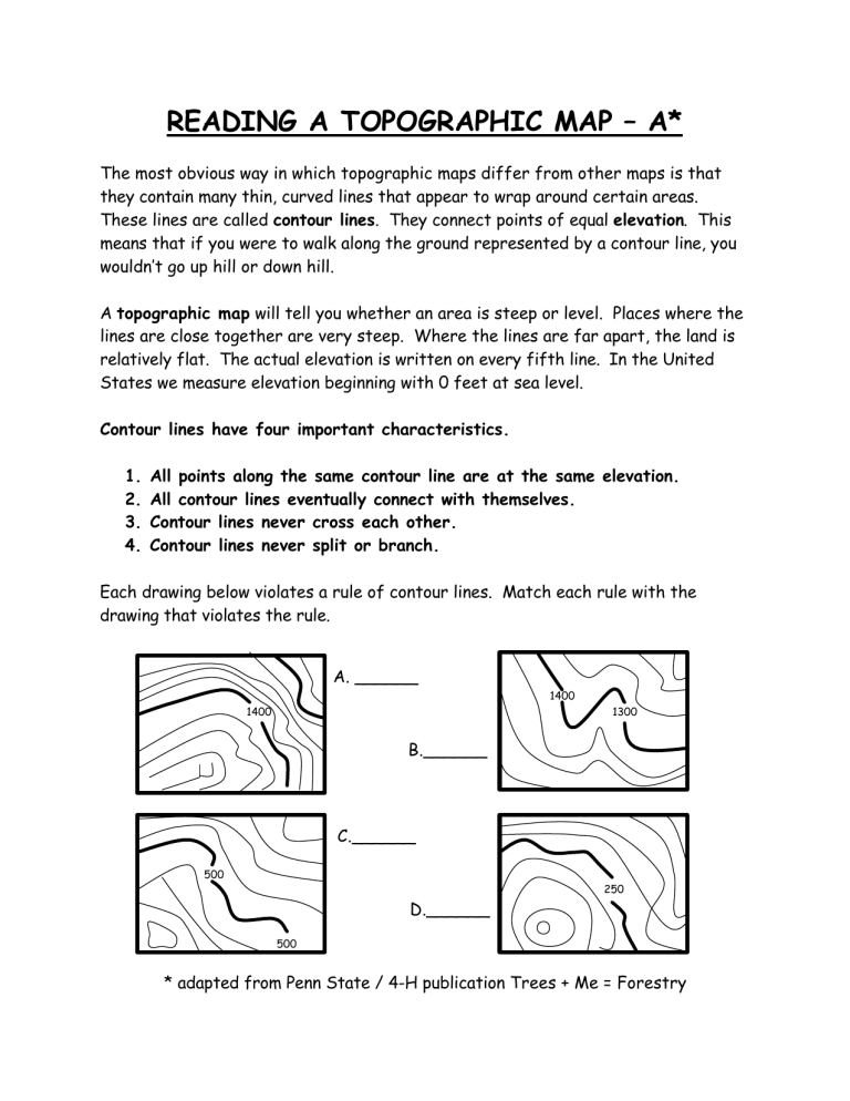
READING A TOPOGRAPHIC MAP – A* The most obvious way in which topographic maps differ from other maps is that they contain many thin, curved lines that appear to wrap around certain areas. These lines are called contour lines. They connect points of equal elevation. This means that if you were to walk along the ground represented by a contour line, you wouldn’t go up hill or down hill. A topographic map will tell you whether an area is steep or level. Places where the lines are close together are very steep. Where the lines are far apart, the land is relatively flat. The actual elevation is written on every fifth line. In the United States we measure elevation beginning with 0 feet at sea level. Contour lines have four important characteristics. 1. 2. 3. 4. All points along the same contour line are at the same elevation. All contour lines eventually connect with themselves. Contour lines never cross each other. Contour lines never split or branch. Each drawing below violates a rule of contour lines. Match each rule with the drawing that violates the rule. A. ______ 1400 1400 1300 B.______ C.______ 500 250 D.______ 500 * adapted from Penn State / 4-H publication Trees + Me = Forestry


