System: SVG Capabilities
advertisement

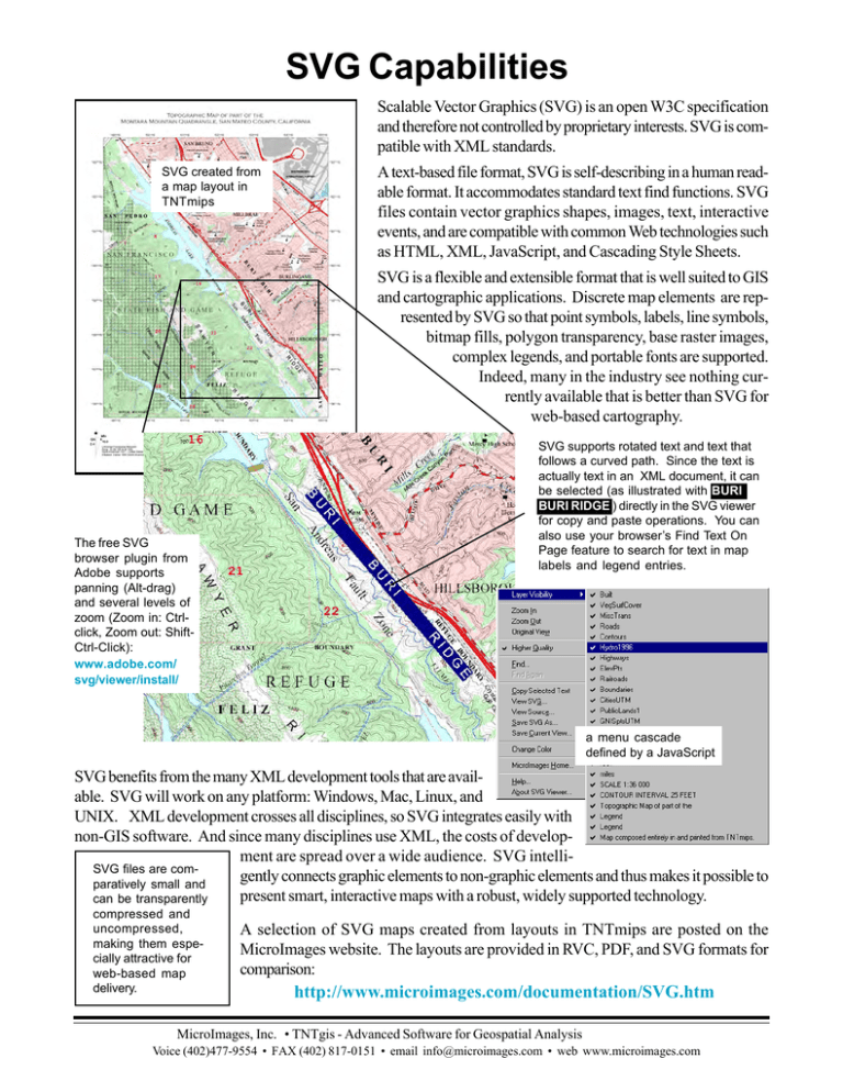
SVG Capabilities Scalable Vector Graphics (SVG) is an open W3C specification and therefore not controlled by proprietary interests. SVG is compatible with XML standards. SVG created from a map layout in TNTmips A text-based file format, SVG is self-describing in a human readable format. It accommodates standard text find functions. SVG files contain vector graphics shapes, images, text, interactive events, and are compatible with common Web technologies such as HTML, XML, JavaScript, and Cascading Style Sheets. SVG is a flexible and extensible format that is well suited to GIS and cartographic applications. Discrete map elements are represented by SVG so that point symbols, labels, line symbols, bitmap fills, polygon transparency, base raster images, complex legends, and portable fonts are supported. Indeed, many in the industry see nothing currently available that is better than SVG for web-based cartography. The free SVG browser plugin from Adobe supports panning (Alt-drag) and several levels of zoom (Zoom in: Ctrlclick, Zoom out: ShiftCtrl-Click): www.adobe.com/ svg/viewer/install/ SVG supports rotated text and text that follows a curved path. Since the text is actually text in an XML document, it can be selected (as illustrated with BURI BURI RIDGE ) directly in the SVG viewer for copy and paste operations. You can also use your browser’s Find Text On Page feature to search for text in map labels and legend entries. a menu cascade defined by a JavaScript SVG benefits from the many XML development tools that are available. SVG will work on any platform: Windows, Mac, Linux, and UNIX. XML development crosses all disciplines, so SVG integrates easily with non-GIS software. And since many disciplines use XML, the costs of development are spread over a wide audience. SVG intelliSVG files are comgently connects graphic elements to non-graphic elements and thus makes it possible to paratively small and present smart, interactive maps with a robust, widely supported technology. can be transparently compressed and uncompressed, making them especially attractive for web-based map delivery. A selection of SVG maps created from layouts in TNTmips are posted on the MicroImages website. The layouts are provided in RVC, PDF, and SVG formats for comparison: http://www.microimages.com/documentation/SVG.htm MicroImages, Inc. • TNTgis - Advanced Software for Geospatial Analysis Voice (402)477-9554 • FAX (402) 817-0151 • email info@microimages.com • web www.microimages.com

