Hurricanes
advertisement
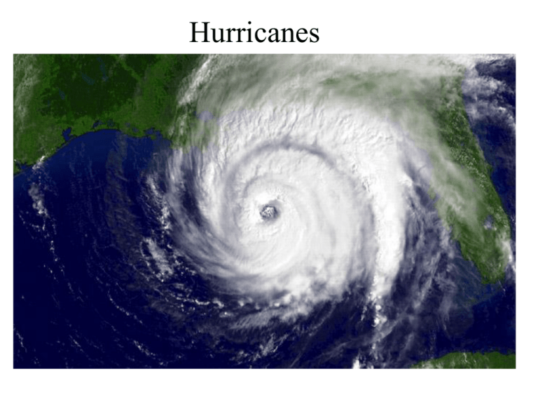
Hurricanes Definition • A tropical cyclone with sustained oneminute winds of at least 74 mph (64 knots), at an elevation of 10 meters. • Derived from the Spanish word "huracan" , which was most likely inspired by Hunraken, the name for the ancient Mayan storm god or Hurakan, the Quiche god of thunder Hurricane Facts • They are tropical cyclones (low pressure areas) with sustained winds at least 64 knots (74 mph). Strongest hurricane on record (Camille) had winds exceeding 200 mph. • Typically 500-1000 km in diameter (smaller than midlatitude cyclones). • Can be associated with heavy rains (10-20 inches!), tornadoes, and storm surges on the coast. • Also called typhoons and tropical cyclones Katrina • 1833 deaths • 125 billion in damage • Most destructive hurricane in U.S. history Fig. 11-24, p. 320 1900 Galveston, TX Hurricane: The Greatest Loss of Life of Any U.S. Meteorological Event (8000 died) Typhoon Haiyan Not on the equator! Fig. 11-10, p. 307 Saffir-Simpson Hurricane Category Table 11-2, p. 313 Fig. 11-16, p. 313 Experience a hurricane http://www.youtube.com/watch?v=H9VpwmtnOZc http://www.youtube.com/watch?v=6LPM-0xiVvM http://www.youtube.com/watch?v=UeM-cjTEEA8&feature=related Atlantic Basin Hurricanes and Tropical Storms Hurricane Structure Major Features: Eye (nearly clear) Eye Wall Rainband Spiral Rainbands Fig. 11-20, p. 317 Fig. 11-18, p. 316 Fig. 11-8, p. 305 Eye slopes outward In much the same way an ice skater spins more quickly as her arms are tucked close into her body, a hurricane also spins at a faster pace near the center than near the outer edge. Destruction most intense on right side of cyclone (wind + storm speed) Eye wall replacement • A shrinking eye indicates storm intensification. • Some intense hurricanes develop double eye walls, as rain bands contract and intensify. • Eye wall replacement leads to weakening of the hurricane winds, followed by renewed strengthening. The Greatest Damage and Loss of Life from Hurricanes is Near the Coast Associated with Storm Surges Fig. 11-15, p. 312 Before and after Hurricane Iva, Sept 2004, coastal Alabama Before a hurricane … After a hurricane. Storm Surge Video http://www.youtube.com/watch?v=nV6Qtrt2CNQ&feature=fvsr http://www.youtube.com/watch?v=l9vDSWugz08 What is the energy source of Hurricanes? Hurricanes • Hurricanes get their energy from the warm, waters of the tropics. • Require the water surface to be at least 80F • Also need moist air through depth and weak wind shear. • Generally develop as a weak tropical disturbance moves over the oceans. Revving Up a Hurricanes: Two Positive Feedbacks Involving Warm Water Convergence-Convection (CISK— Conditional Instability of the Second Kind) Surface flux-Convection (WISHE— Wind Induced Surface Heat Exchange) Hurricane Origin Many Atlantic Hurricanes Begin as Tropical Waves Over Africa Hurricane Prediction: A Mixed Report • During the past thirty years there has been a substantial improvement in hurricane track forecasts as computer models improved and more data became available to describe their environment. • Over the same period only minimal improvement is hurricane intensity forecasts. Katrina 48-h Before: Virtually a Perfect Forecast of Track NOAA P3 “Hurricane Hunter” Aircraft Gulfstream IV-SP (G-IV) is a high altitude, high speed, twin turbofan jet aircraft Substantial Promise • The use of higher resolution prediction and better data around and in hurricanes should result in better intensity predictions. 15-km grid spacing 1.67 km grid spacing U.S Hurricane Headquarters
