Test Four
advertisement
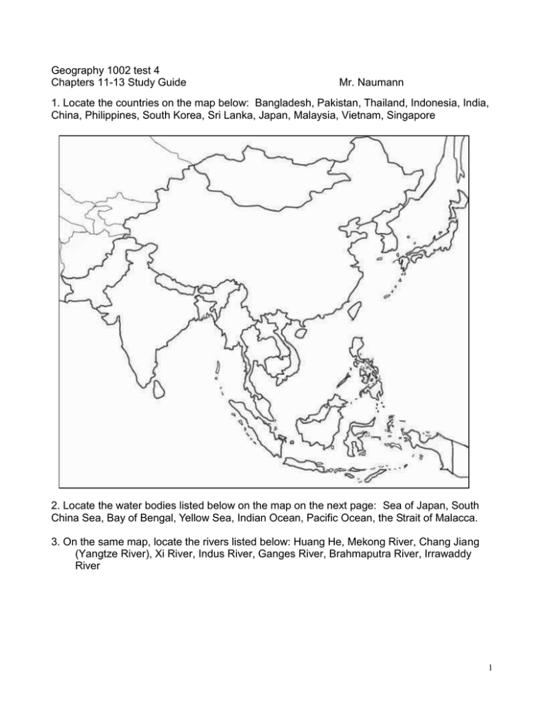
Geography 1002 test 4 Chapters 11-13 Study Guide Mr. Naumann 1. Locate the countries on the map below: Bangladesh, Pakistan, Thailand, Indonesia, India, China, Philippines, South Korea, Sri Lanka, Japan, Malaysia, Vietnam, Singapore 2. Locate the water bodies listed below on the map on the next page: Sea of Japan, South China Sea, Bay of Bengal, Yellow Sea, Indian Ocean, Pacific Ocean, the Strait of Malacca. 3. On the same map, locate the rivers listed below: Huang He, Mekong River, Chang Jiang (Yangtze River), Xi River, Indus River, Ganges River, Brahmaputra River, Irrawaddy River 1 Multiple Choice: Select the best answer for each one. 4. What is the majority religion practiced in Sri Lanka is? 5. The partition of India in 1947 resulted in what human reaction? 6. What were results likely to develop from the Green revolution? 7. Which countries border India? 8. Approximately how long is the doubling time for India’s population? 9. In what subregion did Sikhism develop and in which it is still based? 10. Name the system of social stratification that dominates Hindu India? 11. What is the narrow lowland of far southeastern India that borders the Indian Ocean and contains the city of Chennai (Madras) called? 12. The Bihar-Bengal Industrial region is found near what major city in India? 13. Where is the famous Khyber Pass found? 14. Which capital city in south Asia was established as a forward capital? 15. What is India’s lingua franca? 2 16. In South Asia, “good years” and “bad years” in agriculture are mainly influenced by the timing and intensity of what? 17. How has religious fundamentalism (often with intolerance of differing ideologies) been evidenced in South Asia? 18. South Asia occupies 3% of the world’s land area. What, approximately, is it’s percentage of the world’s population? 19. The Northern Indian Plain receives massive amounts of precipitation during the wet monsoon largely for what reasons? 20. Bangladesh receives much precipitation from the wet monsoon in addition to the water supplied to the large double delta of which two rivers? 21. What were the results of colonial rule in S. Asia? 22. Why did Kashmir become a problem between India and Pakistan? 23. List centripital forces in India. 24. List centrifugal forces in India? 25. Shri Lanka’s Tragedy is the result of what? 26. Due to the mountainous terrain and the wet monsoon, Nepal suffers from what problems? 27. Why is the North China Plain an excellent example of a national core area? 28. Which political unit in this realm is not universally recognized as a sovereign state? 29. Why has Shenzhen been the most successful of China’s Special Economic Zones (SEZs)? 30. What percent of Japan’s land is considered habitable? 31. Which movement was launched by Mao Zedong in the 1960s to rekindle enthusiasm for the Chinese brand of communism? 32. Which region in China is often called “Manchuria” by uninformed foreigners? 33. On which island of Japan is each of these located? Yokohama , Kitakyushu, Nobi Plain, Kyoto, Kanto Plain 34. Be able to locate these: Shanghai, Xinjiang, Chongqing, Wuhan, Three Gorges Dam 35. Which former Japanese islands are now under the political control of Russia 36. Who was the leader of the legendary Long March through interior China? 37. Name Japan’s dominant economic region, which contains its largest city. 38. Which countries or political units are part of the Jakota Triangle? 39. In the 1990s, how did China benefit from its location? 40. China and the U.S.A. both have areas of “C” and “D” climates. What is the major difference between these two locations? 41. Compared to the U.S.A. climatically, China has a larger area of which climate type? 42. The majority of people in China are considered which ethnic group or branch of the Chinese people? 43. Historically, as China expanded, it incorporated minorities. What was the goal of the Chinese rulers toward the cultures of these minorities? 44. Under the Communists in China, what happened to the influence of the teachings of Kongfuzi (Confucius)? 45. Under the communist regime in China, conditions improved in which areas of life? 46. That physiography and demography remain closely related in China is best illustrated by looking at maps of the physiography of China and the population density. This is shown by what pattern? 3 47. Which is the most useful river for transportation in China? 48. To control flooding on the Chang Jiang and generate large amounts of electricity, the Chinese began what project? 49. What is the man-made feature in China which can be seen from orbit around the earth with the naked eye? 50. Which country or political unit is the economic “super Power” in this realm in 2003? 51. After World War II, Japanese economic development was assisted in what ways? 52. Which environmental hazard is most serious in Japan? 53. Which East Asian country has resorted to "pollution exporting" as one means to improve its environment? 54. Where is China most densely populated? 55. Which are the primary manufacturing regions in Japan? 56. The port of Tianjin is becoming a center of industry and serves as the port for the major industrial area around which major Chinese city? 57. In reunited Vietnam, the former capital of South Vietnam (still overwhelmingly called Saigon) is officially named after the communist leader who founded modern North Vietnam. Who was this revolutionary leader 58. Which is the largest Muslim country in the world in terms of population numbers? 59. The city-state of Singapore gained independence in 1965 by seceding from which Southeast Asian country? 60. What political units are located on the island of Borneo? 61. Which countries are touched by the Mekong Rivera? 62. Which city commands access to the Strategic Strait of Malacca? 63. Malaysia is an example of what kind of state based on its shape? 64.Singapore’s population is dominated by which ethnic group? 65. Jakarta is located on what island? 66. Both Thailand and Myanmar are examples of states whose territorial morphologies (shape) can be classified in the same morphological category. What category is that? 67. The most important island of the Philippines contains the capital of Manila. Which island is that? 68. Which is the easternmost island containing Indonesian territory? 69. In which country is the Mekong delta found? 70. Which Southeast Asian country managed to avoid becoming a European colony by taking advantage of its relative location as a buffer between the British Empire and the French Empire? 71. Which ethnic minority group can be found in most Southeast Asian countries 72. Which Southeast Asian countries have not had a period when communist forces controlled the country? 73. In the twentieth century, the influence of the U.S.A. was felt the longest, and probably the most intensely, in which Southeast Asian country? ESSAYS: 1. Why has Southeast Asia been considered a shatter belt, much like the Balkans in Europe? 2. Explain why Indian agriculture is so stagnant. 4 3. Explain how the attitude of the Chinese government toward population control has changed since the 1970s. 4. What is the most controversial large construction project in China in 2002? Explain why it is so controversial. 5. Explain three centripetal forces that exist in India today. 6. Explain three centrifugal forces that exist in India today. 7. Explain how the developments that occurred in Japan between 1850 and 1970 might be called an “Asian Miracle.” 8. Explain the caste system of India and the role it plays today 9. Explain the economic significance of the JAKOTA Triangle. 10. Explain how Japan’s relative location changed during the second half of the twentieth century. 5
