Gordons Bay Fire 6-12 Dec 2008
advertisement
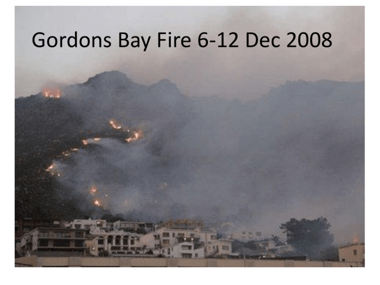
Gordons Bay Fire 6-12 Dec 2008 What happened • • • • Fire started in the Elgin basin (possibly agricultural land) Strong winds on the 6th Dec 2008 Fire caused by people "The combination of a north-easterly wind up in the mountain and a southeaster lower down makes it even more difficult controlling the fire" • About 120 firefighters were being assisted by staff of Nature Conservation, Bulk Water Services and Working on Fire to fight the fires across the Cape. Volunteers of the Disaster Risk Management Centre were assisting with firefighting and public safety-related matters. On Monday the SA Weather Service issued a high fire danger rating for the rest of the week. 6 7 8 9 Scar Scar on 8th MODIS (1,5,7) Were we prepared? • FDI (as calculated by us) 6-9 December 2008 • Fuel loads • Weather Fire Danger Index (FDI) Fire Danger Index (FDI) 6 –9 December 2008 66 64 Fire Danger Index 62 60 58 56 54 6-12-2008 7-12-2008 8-12-2008 Date 9-12-2008 Fuel loads (1)Fire history (David Roy MODIS burned area products): • • • • 2000, 2001 – no fire 2002 – small fires SE of RockView dam 2003 – no fire (previous year fire scar still visible) 2004 - 8 – various small fires to the east of the plantations (forestry operations?) December 2008 – larger area of natural veld at least 8 years or older; high rainfall area => high standing fuel load Fuel loads (3)MODIS EVI • Seasonal variation • Slight downward trend between 2000 – 2008 => alien clearing or maturing of veld (there will be a flush of green straight after fire) but a gradual reduction in growth as vegetation senesces Fuel loads (2)- Veld age Much of veld last burnt more than 10 years ago Consequences (deaths, infrastructure, ha burnt) News24: 9 December 2008: • gutted homes at Gordon's Bay - two homes were completely burned out on Monday night, and another seven affected to varying degrees • 80 people were evacuated from the area • fire had threatened offices, staff quarters, and stores in the Steenbras forestry reserve on Monday night, but it was controlled there and the houses and buildings saved. • No one was injured, but five firefighters had been given medical attention, four of them for smoke inhalation and one for a twisted ankle. Damage • • • • • Total area burned: 11 825 ha Natural areas: 11 465 Urban areas: ~1 Plantations: 280 Agricultural areas: 60 ha 50 Could we have been better prepared 5 December 2008 (News24): • Cape Town - The Western Cape faces a major wildfire risk this summer, Working on Fire (WoF) warned on Friday. "The weather is expected to be exceptionally hot and dry. Heavier than average winter rain has stimulated plant growth, increasing fuel loads," the government-funded fire management organisation said in its December newsletter. • WoF provincial manager Pierre Combrinck said climate data showed the province was entering a five-year phase of longer, wetter winters and windier, drier summers. "That means more wild fires. This season we expect the worst fires in January and February," he said In conclusion • • • • We had FDI warning We had remote sensed information We had fuel load information But if the fire was started it would have spread no matter what
