Unmanned Aerial Inspection Vehicle About the Project Progress on Autonomy
advertisement
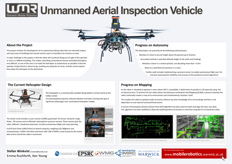
Unmanned Aerial Inspection Vehicle About the Project Progress on Autonomy This project involves the development of an autonomous flying robot that can internally inspect and map areas of buildings that may be hard to reach or hazardous for humans to enter. The Hexacopter can presently do the following autonomously:- A major challenge in this project is that the robot will usually be flying out of sight of the operator or even in a different building. This makes controlling conventional remote controlled helicopters very difficult, so one of the aims is to make the helicopter as autonomous as possible in that the operator simply directs it where to go, avoiding any obstacles en route, and the control system then pilots the helicopter to the destination. Maintain or move to any set height above the ground up to 5metres. Accurately maintain a specified attitude (angle of roll, pitch and heading) Maintain a hover in a certain position, not deviating more than +-0.5m Move to a specified X,Y,Z position in a room. Further work includes implementing a pressure sensor to enable autonomous flight over 5m and also improving the reliability and accuracy of the positional control algorithms. Progress on Mapping The Current Helicopter Design The Hexakopter is a commercially available flying platform aimed mainly at the hobby market. Increased payload capacity, reduced vibration and fewer moving parts give it significant advantages over conventional helicopter models. As the robot is intended to operate in areas where GPS is unavailable, it determines its position in 3D space by using the on-board sensors. To achieve this the robot utilises Simultaneous Localisation And Mapping (SLAM); a process whereby the robot continually creates a map of its environment and simultaneously ‘localises’ itself. This enables the robot to operate inside structures without any prior knowledge of its surroundings and thus is not dependant on any external sensors/infrastructure. A variant of the popular Iterative Closest Point (ICP) algorithm has been used to match and align the laser scan data. This algorithm has been modified to allow the SLAM operation to function in real-time using the PC on-board the robot. The Hexakopter with sensors The sensor array includes a Laser scanner (LiDAR), gyroscopic tilt sensor, ultrasonic range finder , 3D camera and an Altimeter (atmospheric pressure sensor). These sensors give the robot sufficient ‘situational awareness’ to allow autonomous flight and route planning. A pITX form factor (100x72mm) on-board computer, weighing only 180grams and incorporating a 1.6GHz Intel Atom processor with 1Gb of RAM is used to process the sensor data and to control the robot’s movement. The Sensors Stefan Winkvist [S.winkvist@warwick.ac.uk] Emma Rushforth, Ken Young A 3D map of the IMC workshop (top down view, post processed from logged data). The same map as on the left but overlaid on-top of a photo. For more information visit: www.mobilerobotics.warwick.ac.uk

