EUROSDR ROLE IN EUROSPEC DEVELOPMENT
advertisement
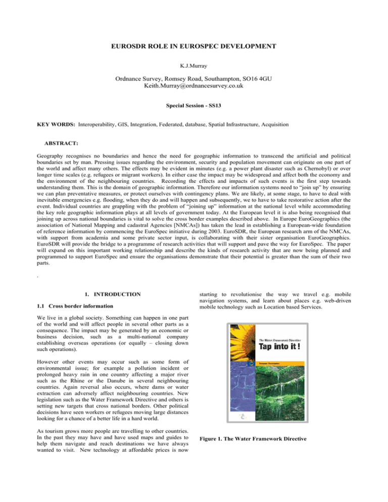
EUROSDR ROLE IN EUROSPEC DEVELOPMENT K.J.Murray Ordnance Survey, Romsey Road, Southampton, SO16 4GU Keith.Murray@ordnancesurvey.co.uk Special Session - SS13 KEY WORDS: Interoperability, GIS, Integration, Federated, database, Spatial Infrastructure, Acquisition ABSTRACT: Geography recognises no boundaries and hence the need for geographic information to transcend the artificial and political boundaries set by man. Pressing issues regarding the environment, security and population movement can originate on one part of the world and affect many others. The effects may be evident in minutes (e.g. a power plant disaster such as Chernobyl) or over longer time scales (e.g. refugees or migrant workers). In either case the impact may be widespread and affect both the economy and the environment of the neighbouring countries. Recording the effects and impacts of such events is the first step towards understanding them. This is the domain of geographic information. Therefore our information systems need to “join up” by ensuring we can plan preventative measures, or protect ourselves with contingency plans. We are likely, at some stage, to have to deal with inevitable emergencies e.g. flooding, when they do and will happen and subsequently, we to have to take restorative action after the event. Individual countries are grappling with the problem of “joining up” information at the national level while accommodating the key role geographic information plays at all levels of government today. At the European level it is also being recognised that joining up across national boundaries is vital to solve the cross border examples described above. In Europe EuroGeographics (the association of National Mapping and cadastral Agencies [NMCAs]) has taken the lead in establishing a European-wide foundation of reference information by commencing the EuroSpec initiative during 2003. EuroSDR, the European research arm of the NMCAs, with support from academia and some private sector input, is collaborating with their sister organisation EuroGeographics. EuroSDR will provide the bridge to a programme of research activities that will support and pave the way for EuroSpec. The paper will expand on this important working relationship and describe the kinds of research activity that are now being planned and programmed to support EuroSpec and ensure the organisations demonstrate that their potential is greater than the sum of their two parts. . 1. INTRODUCTION 1.1 Cross border information starting to revolutionise the way we travel e.g. mobile navigation systems, and learn about places e.g. web-driven mobile technology such as Location based Services. We live in a global society. Something can happen in one part of the world and will affect people in several other parts as a consequence. The impact may be generated by an economic or business decision, such as a multi-national company establishing overseas operations (or equally – closing down such operations). However other events may occur such as some form of environmental issue; for example a pollution incident or prolonged heavy rain in one country affecting a major river such as the Rhine or the Danube in several neighbouring countries. Again reversal also occurs, where dams or water extraction can adversely affect neighbouring countries. New legislation such as the Water Framework Directive and others is setting new targets that cross national borders. Other political decisions have seen workers or refugees moving large distances looking for a chance of a better life in a hard world. As tourism grows more people are travelling to other countries. In the past they may have and have used maps and guides to help them navigate and reach destinations we have always wanted to visit. New technology at affordable prices is now Figure 1. The Water Framework Directive 1.2 The need for consistent up-to-date information In all these cases geographic information (GI) is fundamental in providing a framework within which problems or people are enabled to achieve goals or solve problems. We are familiar in the atlas and paper-mapping world with pan-national mapping. To maximise potential and minimise costs in the digital world, geographic information is more often maintained at the detailed level for national purposes such as planning, registering land and property, crop management etc. From this detailed information, smaller scale mapping is often derived either directly or indirectly via some form of manual generalisation. A fundamental need for most users of GI, paper or digital, is currency – i.e. up-to-dateness. A 10-year-old map of the Athens area is of little use to someone who is arriving by air and hiring a car for example – since the new airport and road network is 20-30km from the former international airport. Similarly a 6-month-old database is of limited use to someone who has to register a new property or planning a new engineering development. 2. EUROSDR 2.1 EuroSDR – a focus for European collaboration EuroSDR [EuroSDR, 2004] is a research platform for national mapping agencies, academic institutes, the private sector, industry and other groups concerned with European spatial data infrastructures vital to sustainable spatial planning and development. EuroSDR members 2004 Figure 2. EuroSDR membership – April 2004 Established in 1953 as OEEPE, the organisation has recently celebrated 50 years of continuous collaboration, and now includes eighteen countries. EuroSDR is governed by a steering committee, which consists of two delegates from each member state, one from the NMCA and one from an educational/research institute, together with representatives from the private sector and geographical information user groups. The interaction between these different groups and the focus of its research on the implementation of GI technology developments make EuroSDR unique in Europe. The aim of EuroSDR is twofold: • To research and develop systems for the production and dissemination of core geospatial data and information, and to promote the applications of all such data and information. • To stimulate interaction and co-operation between research organisations and the public and private sector, to exchange ideas about relevant research problems and to transfer research results obtained to geographical information (GI) production organisations. Figure 2. New technology opens up new horizons Economically and logistically it makes sense to capture information once and re-use it. For example a new housing development or a new highway is required at the detailed level for land registration or planning. This information also affects several forms of derived mapping. Determining solutions to these issues has been central to the objectives of most national mapping and cadastral agencies [NMCA’s] around the world for the last 30 years. Considerable progress has been made at the national level but a new approach is now needed to link up across national borders. The aim also is not just to maintain the same level of service; NMCA’s have to set new and improved levels of service for a wider and more demanding range of customers. 2.2 EuroSDR – a focus for European collaboration The Rolling Research Plan 2004-2006 continues to integrate the existing photogrammetric based activities of the organisations with a much wider scope (strategic and technological issues related to the European Geoinformation Infrastructure). It is recognised that this activity can only be achieved through strengthening international co-operation between the geoinformation users and producers, research communities and industry. To realise this research objective, EuroSDR intends to address a broad range of topics at the forefront of the GI industry. While continuing its research interests concerned with testing performance and applicability of technological developments related to sensors, data acquisition, image analysis and information extraction, the organisation will develop the following research lines: • • Core databases: modern use of core data will be highly integrated with other data. Semantic content of the databases will be more critical with the effect that the importance of data quality, including thematic content, completeness and currency of the data will, require more attention. This raises issues related to structure, modelling, semantic aspects, up-down-scaling and updating. Integration: GI production should be based on the integration of data sources; no source should be any longer treated in isolation. The provision of reference data promotes integration. • Information dissemination: This will address technological issues related to the dissemination of GI on the Internet. • Development of Rules of Best Practices for subcontracting/ outsourcing and quality assurance/ control thereof. • Testing of de facto and de jure Standards • Testing Proposals resulting from other initiatives. 2.3 EuroGeographics EuroGeographics [EuroGeographics, 2004] is an organisation formed by the heads of almost 40 NMCAs and other bodies across Europe. Its aim “to achieve interoperability of European mapping (and other GI) data within 10 years and so help the public and private sectors develop good governance, sustainable growth and benefit future generations” Both EuroSDR [formerly OEEPE] and EuroGeographics [formerly CERCO & MEGRIN] have undergone significant change in recent years and offer a complementary agenda. This should reinforce closer collaboration in future to manage the significant challenges that lie ahead and those in particular that lie in the hands of the NMCAs. 3. EUROSPEC 3.1 Pan European Reference data EuroSpec [EuroSpec, 2004] is described in more detail in the proceedings of this conference [Luzet & Land, 2004]. EuroSpec is addressing the issue of GI interoperability across Europe to provide a better infrastructure to solve the challenges we face today, some of which were highlighted in the introduction to this paper. EuroSpec does not aim to create a unique centralised panEuropean database, and does not aim to develop a uniform specification for all databases and all applications in Europe. It’s primary aim to establish the conditions for efficient access and use of GI residing and updated by the source providers. This implies a common technical language, based on a shared EuroSpec Schema, and a common business language, based on a shared understanding of pricing and licensing terms. Db z enduser Transformation mechanisms & interface Db y Euro Reference Data & Metadata Db x VAR applicat ion EuroSpec ISO Figure 4. The EuroSpec distributed supply model Source data resides with the serving organisation, normally the NMCA; in some countries [e.g. Austria & Germany] the state/regional body may supply their data via the NMCA. EuroSpec will focus on common interoperable specifications for what the European Commissions INSPIRE initiative has defined as the “Common Reference Data”, covering 7 main themes: • • • • • • • Geodetic reference Units of administration Units of property rights (parcels, buildings) Addresses Topography (e.g. hydrography, transport, height) Orthoimagery Geographical names 3.2 Interoperability Interoperability appears to be a universal word but in the sense of EuroSpec we need to achieve technical and business interoperability. In terms of the information the need is horizontally (across nations) and vertically (across the different themes of data and information) if true seamless and effective exchange of application data is to be achieved. Application data is that data which is used by someone to fulfil a purpose e.g. a river quality record at a point, traffic flows along a section of highway, crop grown in a specific field on a given year, a route used to get from a to b and so on. Application data will be referenced to a common base i.e. the reference data. 3.3 EuroSpec programme Within the EuroSpec programme there are several major components of work such as the EuroRoadS project [EuroRoadS, 2004]. These are all supported by a business and technical infrastructure framework, within which lies a field of technical research to ensure that EuroSpec is both informed and prepared on specific issues across the programme. 4. RESEARCH OPPORTUNITIES 4.1 EuroSDR Track Record EuroSDR has a comprehensive track record over its 50 years of operation. This has included some very significant projects such as the aerial triangulation testbed, though such projects have tended been the exception rather than the rule. In recent years workshops have become a more popular way of addressing issues. The benefit of focussing on a current issue has been helpful in sharing knowledge from several organisations over an intensive 2-3 days and in: • • • Better understanding the topic Quickly gaining a European perspective Analysing alternative approaches – and determining o what works o what has not worked Raising awareness Sharing knowledge Influencing strategy Convergence towards a common vision Building a network of GI experts across Europe • • • • • . The workshops are normally written up and published along with the presentations and distributed to the attendees within a few weeks. This material is then reformatted and published in the next available official EuroSDR publication. o o Next Generation Spatial Data Bases o o o o o NMA and the Internet o o o The workshop held in Southampton in spring 2000, reviewed the state of the art in the use of the Internet by NMCAs with presentations from a global perspective, European NMCAs and industry-GI vendors. The workshop was successful in influencing the future direction of many of the organisations involved. The outcome is reported in the official publication No: 38. From 2D to 3D – Establishment and maintenance of National Core Geospatial Databases o o o Held in Hannover in autumn 2001, participants heard how new technologies are changing the way society interacts. The world is a 3D place and GI methods and practices are developing to support and manage real world events. While capability is improving and there are several areas of innovation, the adoption of 3D or even 2.5D in GI remains limited. The workshop is reported in the official publication No: 42. XML/GML [Geography mark-Up Language] o The workshop held in Marne la Vallee, near Paris in late 2001 included tutorials, reviews and Held in Southampton in Spring 2002 and inspired by a glimpse of the possible future underpinned by ‘grid’ technology this workshop brought together database experts and industry to share plans in managing the migration from digital mapping to geographic information over the next 3-5 years. A common strategy is to move to a database centric approach (rather than flat files) while separating the master maintenance database from the publishing database servers. The outcome is reported in the official publication No: 45 Spatial Data Quality Management 4.2 Recent Workshops Recent workshops, which are of relevance to EuroSpec over the last four years, include: implementations of GML, with position statements from experts and several vendors. A key outcome was a better understanding of the role of GML as a GI communication language, i.e. not specifically as a transfer format, and its increasing adoption. A report of the workshop will be found in official publication No: 42 o This workshop, held in Istanbul in spring 2002, heard how NMCAs are managing data quality, the use of standards and in particular the interface with contractors now supporting NMCAs in several areas of data collection and maintenance. The meeting reinforced the view that in a database centric world the issue of data quality is of increasing importance and requires more attention. A compendium of the papers is included in the official publication No: 45 Visualisation and Rendering o o o The workshop held in Enschede, in early 2003 heard from industry and users who are starting to exploit all kinds of new technologies in innovating the use of GI often through virtual reality and 3D. Like the 2D to 3D workshop it was felt that “mainstream users” and decision makers are still adjusting to GIS and do not yet readily use 3D capabilities. More work is required to make data and information easier to use. The workshop will be reported in official publication No. 47. EuroSpec Workshops 1 &2 o Both held in Marne la Vallee, near Paris in spring and summer 2003. Led by EuroGeographics and co-sponsored by EuroSDR (and the Joint Research Centre of the European Commission in the case of workshop 2) these workshops set out to better understand and define EuroSpec. The participants heard from several experts across the NMCAs, the European Commission, ISOTC211 and other collaboration projects such as EULIS. o o The workshops were successful in raising the profile of EuroSpec across the stakeholder groups and the issues that need to be resolved. The outcome fed into a plan to take forward EuroSpec and approved at the EuroGeographics general assembly in autumn 2003. The workshop findings and presentations will be found on the EuroGeographics web site [EuroSpec, 2004] Ontologies and Schema Translation Services o o Held in Marne la Vallee, near Paris in spring 2004 this workshop heard from several experts on research into taxonomies and ways of classifying geographic objects. This is not only important in establishing a more recognisable set of objects but in relating these from one organisation to another at national or international levels to establish a seamless mapping capability and achieve greater automation. The workshop will be reported in a future official publication. EuroSDR has driven all but the EuroSpec workshops but several of these have been jointly sponsored in collaboration with other bodies including EuroGeographics, ISPRS and others, such the host organisations. The workshop programme is consolidating a network of very specific GI expertise across Europe. 4.3 Future Plans Based on this successful track record, there are several areas for future investigation already being planned. Some of these are described below, others will start to emerge, driven to underpin the EuroSpec programme goals and objectives. Where appropriate, and where there is general support, projects or some other form of collaboration may emerge from the workshop. Wider collaboration will also extend to build stronger links with other organisations such as ISPRS, ICA, FIG, AGILE and OpenGIS. generalisation and multi-scale data. The requirement arises from the need to reduce the number of ‘flowlines’ and to improve consistency and currency across outputs from an NMCA. Specific issues to be addressed include: • • • Possible future topics 2D to 3D. Further work is envisaged following on from the previous workshops to develop pragmatic approaches to the height element and support the growing requirements in land registration, georeferencing and planning. Research topics proposed include: • • • • • • • The extent of positional accuracy problem internationally, The drivers that are now forcing NMCAs to address positional accuracy issues. The inevitable impact this has on users, their data holdings and maintenance regimes and How this process is managed. Map Generalisation, Leicester – summer 2004 In conjunction with the International Cartographic Association, this workshop will investigate issues involved with GI The definition, utility and implementation of capabilities short of (and less expensive than) full 3D. These include 2.5D and multi-surface capabilities The possibilities for a unified 3D data model handling both geospatial and engineering/CAD/architectural models The possibilities for a ‘hybrid’ approach, with linkages between the geospatial model and the CAD/engineering/architecture models operating in a seamless manner Georeferencing, Data Integration and Modelling In a database environment, careful data modelling is critical to enable and provide access to the data. There is always an inevitable balance, or trade off, in terms of developing the richness (and perhaps complexity) of the data model vs. the practicality of achieving an effective operational system. The workshop is envisaged to explore: • • • Forthcoming Workshops Impacts of improving the positional accuracy of GI databases, Dublin – spring 2004 In conjunction with the Dublin Institute of Technology [DIT], who also are part funding the event and FIG, the workshop will address the issues created when the position of reference data is changed as a result of some improvement in data quality or other policy change. The workshop will focus on: The role of the model in generalisation, with a separate cartographic (or rendering) process. Rules for model generalisation, including 3D data. The propagation of updates across scales • • Data Models. Are these user/organisation driven or vendor driven? Object Identifiers. The trend towards object models and the use of persistent identifiers is growing. Object Semantics. Research is needed into object semantics and the consistency (or otherwise) of the approaches being adopted History and Versioning. It is not clear whether the capabilities emerging from database technology will be sufficient for the needs of geospatial core data (particularly at very high granularity). Object Lifecycle. The models and relationships of reference data and application data. Data Quality – setting and achieving acceptable levels. Currency, consistency, completeness, interoperability and accuracy are all critical characteristics of a database centric environment. This raises several questions: • • • • • Do organisations (NMCAs and users) set targets to manage these aspects of their data? What drives those targets? Internal or external needs? How are quality statements prepared and the information? What techniques are used to assure data quality? What, if anything, needs to change to support quality statements of pan-European datasets? Web Feature Serving As the growth in data and information significantly increases so too does the complexity of data management. It is not just the volume of data that is provides a challenge but the internal integrity of the data as well. In the near future some of this burden could be lifted by the elimination of the need to store and hold 3rd party data on your own system. With high bandwidth networks and resilient servers you will simply access the data you need, when you want it - from a 3rd party server. There are lots of benefits and several issues associated with this model and a workshop in the future will investigate them: • • • • • Is the technology available to implement this model? o If not – what needs to happen? What are implications for the data providers? What are the implications for the users? What are the implications for end-users i.e. the citizen? What are the implications for the GI data industry and stakeholders in that industry e.g. value added resellers, systems integrators? As incoming the President of EuroSDR [2004-2006] I see this as a very interesting but challenging period for EuroSDR. We need to build on the last 50 years of achievement, the last few years of change and refocused energy in all the EuroSDR Commissions and in particular: • • • Continue to strengthen our network of experts Collaborate in the building of the European Spatial Data Infrastructure Develop further our strong programme of workshops to underpin this development. 5. CONCLUSIONS From all of this we can safely conclude that “the only constant is change” and this is particularly true in terms of the GI industry. Further: • The need for pan-European information is growing and EuroSpec is a fundamental component of the European Spatial Data Infrastructure. • EuroSDR and EuroGeographics as organisations have undergone change in recent years to meet the demanding new challenges ahead. The two organisations are building a collaborative relationship to underpin the development of EuroSpec. • EuroSDR has established a very successful track record of technical workshops that help improve and share knowledge, develop a common vision and offer guidance by benchmarking current technical issues and publishing state of the art position statements. • The programme of workshops is set to develop further and extend the network into a powerful body of expertise across Europe. This offers both a cost effective and invaluable service in support of the exciting, but challenging days ahead. REFERENCES Literature: Luzet C., & Land N., (2004). EuroSpec – a cornerstone for the building of the European Spatial Data Infrastructure. The International Archives of the Photogrammetry, Remote Sensing and Spatial Information Sciences. Istanbul. Turkey. [In preparation] Websites: European Commission (2004). Homepage of the INSPIRE website. Available from: http://inspire.jrc.it/home.html (accessed 30 April 2004) EuroGeographics (2004.) Homepage of EuroGeographics. Available from: http://www.eurogeographics.org/ (accessed 2 May 2004) EuroRoadS (2004.) Homepage of the EuroRoadS project. Available from: http://www.euroroads.org/ (accessed 2 May 2004) EuroSDR (2004.) Homepage of EuroSDR, which also contains references to the official publications. Available from: http://www.eurosdr.org/ (accessed 2 May 2004) EuroSpec (2004.) Main page of the EuroSpec programme. Available from: http://www.eurogeographics.org/eng/03_projects_eurospec.asp (accessed 2 May 2004)
