Document 11340660
advertisement
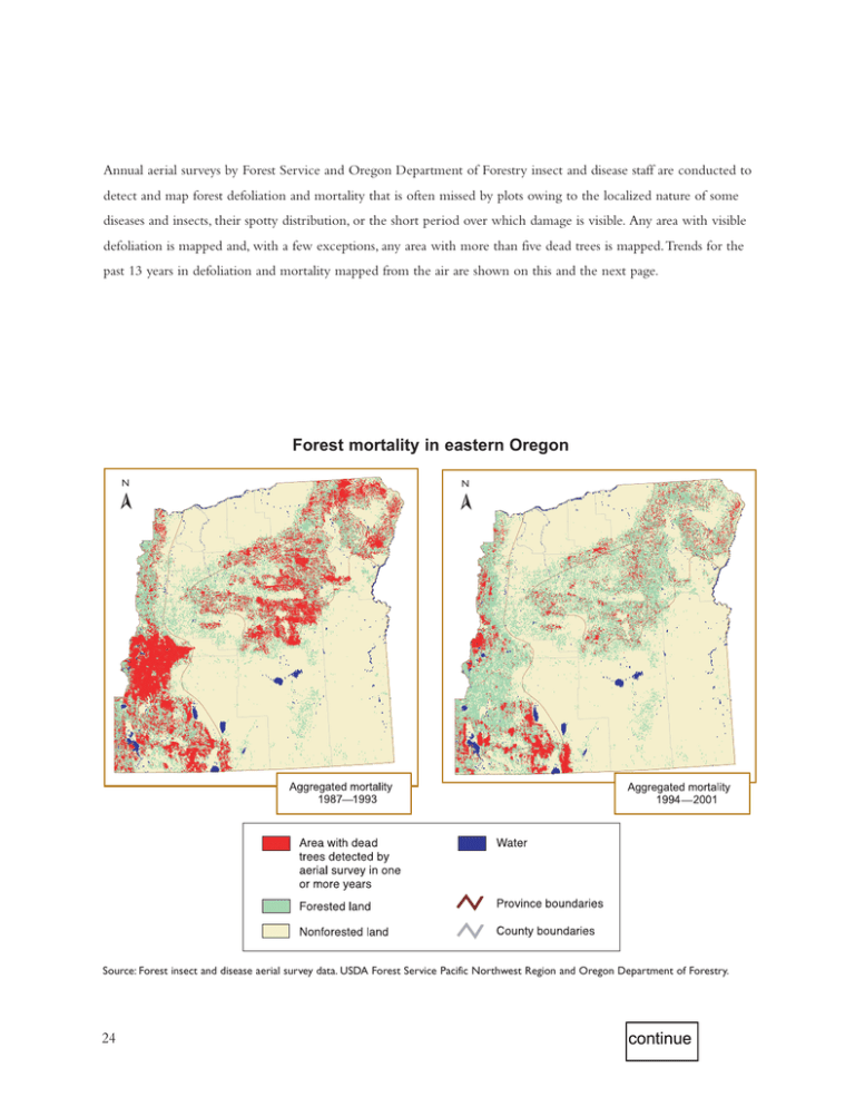
Annual aerial surveys by Forest Service and Oregon Department of Forestry insect and disease staff are conducted to detect and map forest defoliation and mortality that is often missed by plots owing to the localized nature of some diseases and insects, their spotty distribution, or the short period over which damage is visible. Any area with visible defoliation is mapped and, with a few exceptions, any area with more than five dead trees is mapped.Trends for the past 13 years in defoliation and mortality mapped from the air are shown on this and the next page. N N ➢ ➢ Forest mortality in eastern Oregon Source: Forest insect and disease aerial survey data. USDA Forest Service Pacific Northwest Region and Oregon Department of Forestry. 24 continue
