PACIFIC SOUTHWEST Forest and Range Experiment Station ROAD CONSTRUCTION ON
advertisement
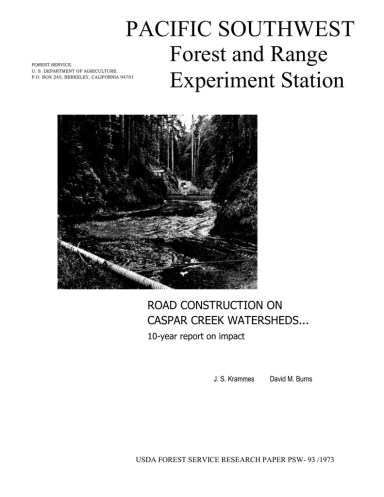
PACIFIC SOUTHWEST Forest and Range Experiment Station FOREST SERVICE. U. S. DEPARTMENT OF AGRICULTURE P.O. BOX 245, BERKELEY, CALIFORNIA 94701 ROAD CONSTRUCTION ON CASPAR CREEK WATERSHEDS... 10-year report on impact J. S. Krammes David M. Burns USDA FOREST SERVICE RESEARCH PAPER PSW- 93 /1973 CONTENTS Page Summary . . . . . . . . . . . . . . . . . . . . . . . . . . . . . . . . . . . . . . . . . . . . . . . . . . . . . .1 Introduction . . . . . . . . . . . . . . . . . . . . . . . . . . . . . . . . . . . . . . . . . . . . . . . . . . . 3 Soils and Geology . . . . . . . . . . . . . . . . . . . . . . . . . . . . . . . . . . . . . . . . . . . . . . 3 Treatments and Measurements . . . . . . . . . . . . . . . . . . . . . . . . . . . . . . . . . . . . . 4 Silvicultural Systems . . . . . . . . . . . . . . . . . . . . . . . . . . . . . . . . . . . . . . 5 Road Construction . . . . . . . . . . . . . . . . . . . . . . . . . . . . . . . . . . . . . . . . 5 Streamflow and Sedimentation . . . . . . . . . . . . . . . . . . . . . . . . . . . . . . . . . . . . 5 Erosion and Landslides . . . . . . . . . . . . . . . . . . . . . . . . .. . . . . . . . . . . . 5 Stream Turbidity . . . . . . . . . . . . . . . . . . . . . . . . . . . . . . . . . . . . . . . . . 6 Suspended Sediment . . . . . . . . . . . . . . . . . . . . . . . . . . . . . . . . . . . . . . 6 Debris Basin Deposition . . . . . . . . . . . . . . . . . . . . . . . . . . . . . . . . . . . 7 Aquatic Habitat Changes . . . . . . . . . . . . . . . . . . . . . . . . . . . . . . . . . . . . . . . . 7 Temperature and Radiation . . . . . . . . . . . . . . . . . . . . . . . . . . . . . . . . 7 Dissolved Oxygen . . . . . . . . . . . . . . . . . . . . . . . . . . . . . . . . . . . . . . . . 8 Food Production . . . . . . . . . . . . . . . . . . . . . . . . . . . . . . . . . . . . . . . . . 8 Fish Populations . . . . . . . . . . . . . . . . . . . . . . . . . . . . . . . . . . . . . . . . . . . . . . . 8 Population Densities . . . . . . . . . . . . . . . . . . . . . . . . . . . . . . . . . . . . . . 9 Streambed Composition . . . . . . . . . . . . . . . . . . . . . . . . . . . . . . . . . . 10 Literature Cited. . . . . . . . . . . . . . . . . . . . . . . . . . . . . . . . . . . . . . . . . . . . . . . 10 THE AUTHORS J. S. KRAMMES was in charge of the Station's research on flood and sediment reduction in California's north coast ranges, with headquarters at Arcata, from 1968 to 1972. He is now assistant to the chief, watershed and aquatic habitat research branch, Forest Service, Washington, D. C. A forestry graduate (B.S., 1958; M.S.F., 1963) of the University of Montana, he also earned a doctorate in forest hydrology (1968) at Oregon State University. He joined the Forest Service in 1958. DAVID M. BURNS is a staff forester in the State Forester's office, California Division of Forestry, Sacramento. He is a 1959 forestry graduate of the University of California, Berkeley. He began his career in the Division of Forestry in 1959. The next year, he transferred to the Jackson State Forest, headquartered at Fort Bragg. He served as assistant manager of the Forest from 1962 until 1968, when he assumed his present position. SUMMARY Krammes, J. S., and David M. Bums. 1973. Road construction on Caspar Creek watersheds . . . 10-year report on impact. Pacific Southwest Forest and Range Exp. Stn., Berkeley, Calif. 10 p., illus. (USDA Forest Serv. Res. Paper PSW-93) Oxford: 383:116.38:(794). Retrieval Terms: bridge building; road construction; logging operations; environmental impact; streamflow; sedimentation; fish habitat; Caspar Creek; California. cover. Road construction did not significantly effect the volume of living space for fish populations. Young-of-the-year fish populations decreased immediately after road construction. Some of the change in population census was the result of migration and of population adjustment to stream carrying capacity. The combined populations of steelhead and salmon smolts decreased 20 percent, but this decline is estimated to be within the range of natural fluctuation reported for other California streams. Streambed particle size composition changed during the period of observation following road construction, but with no deleterious effect on fish habitat. The long-term effects of road building and logging remain to be established. In 1960, Federal and State agencies jointly started a long-term study of the effects of logging and road building on streamflow, sedimentation, aquatic habitat, and fish populations on two watersheds of Caspar Creek, in northern California. The experimental watersheds are the North and South Forks of the Creek. The data being collected consist of continuous streamflow measurements, suspended sediment measured at weirs, changes in sediment deposition in debris basins behind the weirs, and rainfall. Effects of roads built in summer 1967 were monitored between 1967 and 1971. This paper summarizes data from 10 years of streamflow calibration and 4 years of recording effects of road construction and use. Generally, the immediate impact of right-of-way clearing, road building, and bridge construction was best reflected in the suspended sediment yield. Turbidity levels were high during the road building period, but did not extend far downstream nor persist for extended periods during summer. Suspended sediment yields the first winter were more than four times the preconstruction levels; subsequent winter levels, while still above preconstruction, were not excessive. There was a small increase in sediment deposited in the basin behind the weir during the first 3 winters after road construction, and a major increase the fourth winter. An old splash dam located more than 2 miles upstream from the weir failed during the first winter and added over 900 cubic yards of sediment to the channel. This surge may have been responsible for the fourth winter increase. Water temperatures were raised slightly, increasing the production of bacteria, algae, and the insects upon which fish feed. Dissolved oxygen concentrations were not adversely affected by construction activities or by removal of stream-side vegetative 1 limits. The study is not intended to compare differences in types of logging practices or road building methods. The two experimental watersheds are the North and South Forks of Caspar Creek. They are in the second-growth, redwood-Douglas-fir forest type (fig. 1). The Creek flows into the Pacific Ocean about 6 miles south of Fort Bragg. The South Fork study area consists of about 1,047 acres; the North Fork study area, about 1,255 acres. Both watersheds were clearcut and burned in the late 1800's. In 1961, both supported adequately stocked stands of secondgrowth Douglas-fir, redwood, hemlock, and grand fir that ranged from 65 to 85 years old. The timber stand in the South Fork averaged 85 years old; the stand in the North Fork, 65 years old. Because of the age difference, the North Fork was selected as the control; and the South Fork as the watershed to be selectively harvested. This paper reports on streamflow calibrations in the two Caspar Creek watersheds during the first 10 years, and on the effects of road construction during a 4-year period on sediment yield, aquatic habitat, and fish populations. The findings reported may provide useful information for the prudent management of other watersheds, in the north coastal area of California, that have generally similar soils and geology. Logging and road building affect streamflow, sedimentation, and aquatic habitat in forested watersheds. But how decisive an impact do they have? And for how long must effects be studied to be considered significant? Forest managers would find the answers to these and other questions useful in determining appropriate methods for timber harvesting and for designing logging roads. To come up with some answers, a number of Federal and State agencies in California began a joint study in 1960 on two Caspar Creek watersheds of the Jackson State Forest, near Fort Bragg, California. The agencies participating are the Pacific Southwest Forest and Range Experiment Station, California Division of Forestry, and California State University, Humboldt. Earlier participants included the California Departments of Fish and Game and of Water Resources. The study is designed to develop quantitative data on the impact of selection cutting and attendant road systems on streamflow, sediment, and fish habitat. In applying this cutting technique, about two thirds of the timber volume is to be removed. Timber harvesting and road location, design, and construction are all to standards consistent with the intensive management objectives of Forestry. Attention to watershed protection values is kept to within practical SOILS AND GEOLOGY marine terrace deposits of sand and gravel. The deposits are the parent material for the Caspar and Noyo soils. This substratum is generally firm, moderately permeable, and medium to high in moisture retention-a factor that was considered when the beginning of the logging season was set. Gladish1 concluded that the two major soils in the experimental watersheds differed only slightly in surface erodibility. Furthermore, sediment sources would most likely be associated with logging activities adjacent to water courses, and from mass movements, particularly where roads cut through dormant landslides. The geology of the experimental watersheds appears representative of western Mendocino County. Sedimentary rocks of Cretaceous age underlie most of both watersheds. Soils mapped on these rocks are of the Hugo and Mendocino soil series. Rocks underlying the Hugo soils are hard sandstone and shale, moderately weathered, coarse-grained, and deeply shattered. This kind of fractured substratum receives drainage water rapidly, but has only a moderately high water-holding capacity. In contrast, the sandstone associated with the Mendocino soil is highly weathered-often streaked with lenses of red and white clay. These rocks appear slightly less permeable and were estimated to retain slightly more water than those under the Hugo soils.1 Less than 10 percent of the South Fork watershed is underlain with weakly consolidated Pleistocene 1 Gladish, E. N. Soils and vegetation of the Caspar Creek watersheds. 1963. (Unpublished report on file at California Division of Forestry, Sacramento, Calif.) 3 Figure 1-The two experimental watersheds in the Caspar Creek study are the North and South Forks on the Jackson State Forest, in northern California. TREATMENTS AND MEASUREMENTS to be selectively harvested in three consecutive annual sales. Starting at the weir and moving upstream, each sale would be completed in one logging season. Annual sales would remove between 10 and 14 million board feet of timber, averaging about 63 percent of the timber stand volume (table 1). Timber harvested from the 1967 road right-of-way clearing was included to present a total accounting. The three main considerations which led to the choice of sale areas and scheduling sequence were: 1. Timber volume involved in each of the three sales is consistent with the State Forest timber sale policies. Planned volumes can be removed in one logging season by using available equipment. 2. Ridge-to-ridge sale boundaries provided the most orderly plan for the systematic timber harvest. 3. Starting the first timber sale near the weir, with subsequent sales upstream, should permit better evaluation of sediment source areas without having a Both watersheds were monitored in an undisturbed condition between 1962 and 1966. A main haul logging road and spurs were built in the summer of 1967 in the South Fork watershed. Effects of the roads were monitored between 1967 and 1971. Timber harvesting started in March 1971 in the South Fork drainage, and the harvesting effects are to be evaluated until about 1977. A weir was completed in each fork in November 1962. The continuing data collected at each site consists of continuous streamflow measurements, suspended sediment measured at the weirs (stagetriggered and supplemented by hand sampling), measurement of changes in sediment deposition in the debris basins behind the weirs, and rainfall. Changes in aquatic habitat upstream from the weir were measured periodically at 60 stations in the North Fork and 77 stations in the South Fork watershed. Stations were located at 100-foot intervals upstream from the weirs in each fork. Two stream channel sections totaling 2,000 feet of the South Fork streambed were mapped in detail. The maps indicate location and extent of pools and riffles, stream width, meander, general nature and extent of bottom materials, prominent landmarks, and location and extent of beds of aquatic vegetation. In addition, sections of the stream, of bottom materials, and of the floral canopy were photographed. The sections have not been re-mapped, as there appear to be little change in them to date. The last phase of the study-the harvesting and logging operation-began in March 1971. Timber was Table 1-Estimated timber sale volume in the South Fork watershed, Caspar Creek, Jackson State Forest, California Sale area Year Acres Area 1 Area 2 Area 3 Total Right-of-way 1971 1972 1973 1967 249 316 435 1,000 47 Harvest Leave - - - - MM. bd. ft. - - - - 4 10.3 13.6 12.1 36.0 4.0 7.1 6.2 7.9 21.2 - Figure 2-Typical section of a logging road built in the South Fork drainage of Caspar Creek. The road was completed in September 1967. cumulative effect as might happen if the sequence of logging were reversed (fig. 1). Silvicultural Systems The major second-growth stand is now about 95 years old and consists of redwood (Sequoia sempervirens), Douglas-fir (Pseudotsuga menziesii), grand fir (Abies grandis), hemlock (Tsuga heterophylla), and bishop pine (Pinus muricata). There are also some scattered old-growth trees. The selection cutting, as being applied, will remove single trees and small groups of trees with the objectives of reserving healthy, fast growing stands of the more desirable species, and of providing openings to encourage regeneration of the same species. Most of the scattered old-growth timber is to be removed. About 50 percent of the young-growth redwood and Douglas-fir, and about 60 percent of the grand fir, trees are to be removed. Hemlock and bishop pine are to be marked heavily to favor the other species. Near the county roads and the boundary of Russian Gulch State Park, marking is lighter, with special consideration for esthetic values. Some oldgrowth trees are left. The lighter marking merges in to standard marking at 50 to 200 feet, depending on the local situation. The light marking should also provide a windbreak along the southern perimeter where there are sandy soils and trees are susceptible to windthrow. right-of-way clearing, that was in the stream and along its banks was mostly removed after road construction. Some of the road-building and bridge construction directly affected the perennial stream, its bed, and its banks. Small trees, many branches and leaves, and considerable quantities of rock and soil slid into, or were deposited at, several locations in the stream. Almost the full length of the aquatic habitat study area was directly affected in one way or another by the road-building activities. About 360 feet of streambed were disturbed by tractor operation directly in the stream. These areas were primarily around bridge crossing locations, landing sites, and in a stretch of stream cleared of debris from right-of-way clearing. All fill slopes, landings and major areas of soil exposed by the road-building activities were fertilized and seeded with annual ryegrass (Lolium multiflorum) in September 1967. The grass was well established before the first rains in November (Jackman and Stoneman 1973). Road Construction Right-of-way clearing for constructing the logging road and main spur roads in the South Fork drainage began at the upper end of the watershed in May 1967. Generally, clearing and road work progressed downstream toward the weir. All road and bridge construction and all stream cleaning activities were completed by September 12, 1967 (fig. 2). About 4.2 miles of road were built, of which about 3.7 miles were in the aquatic habitat study area. Coarse debris, resulting largely from STREAMFLOW AND SEDIMENTATION Erosion and Landslides steeper cut slopes and from fill areas next to bridge sites. An estimated 500 cubic yards of soil and rock material from cut banks was deposited on the road in 19 separate slides along 2,000 feet of road. Sixteen Winter rains in 1967-68 resulted in some mass movement within road prisms, particularly in the 5 yond a mile downstream. Maximum observed turbidity during the summer low flow period was about 4,000 p.p.m., caused by a tractor preparing bridge footings. The next day, the observed maximum at the bridge site was 18 p.p.m.; 700 feet downstream from the bridge site, the concentration had returned to the observed preconstruction level of around 1 p.p.m. The presence of the new road, plus the failure of the splash dam, must be held responsible for peak increases in turbidity in the South Fork during the winter of 1967-68. During a period of moderate rainfall in mid-January 1968 turbidities were as high as 3,000 p.p.m. in the South Fork study area, at least as far upstream as 4,600 feet from the weir. Because samples were taken only during visits to the study area, they may not represent maximum concentrations. Turbidity values greater than the preconstruction level were not measured during summer low flow periods subsequent to the 1967 road building season. slides along the fill slopes contributed an estimated 150 cubic yards directly to stream. No estimate is available for volume of material eroded from areas next to bridge sites or the amount of material that may have spilled into the stream during road maintenance. A splash dam had been constructed on the South Fork during the first timber harvest in the 1880's for transporting logs downstream. This dam, about 10,800 feet upstream from the South Fork weir, failed in December 1967. The road crossed the South Fork at a point 300 feet above the old splash dam, on the upper end of the estimated 5,600 cubic yards of sediment that had been trapped behind the dam. Considerable debris was removed from the channel between the dam and the road crossing. These construction activities may have hastened the dam failure. In any case, an estimated 925 cubic yards of sediment entered the stream as it cut a new channel through the trapped sediment, to be added to material coming directly from road-building activities. Most sediment from both sources entered the channel during, the winter of 1967-68, and it is not possible to say how much of the subsequently measured downstream sedimentation originated from each. Peak flow periods during the first winter were not of sufficient length or magnitude to transport bed material for long distances; hence an unusual amount of sediment did not accumulate in the sedimentation basin during the 1967-68 measurement. By June 1968, the streambed generally did not appear much different from the way it looked before the roads were built. This lack of visible streambed change was due to the distribution and the leveling of sediment all along the stream. Suspended Sediment Suspended sediment is the parameter most often used as an index to estimate erosion from a watershed. Since sediment concentrations under undisturbed conditions vary widely, isolated samples do not directly represent watershed conditions. Longterm relationships between suspended load and stream discharge must be developed before suspended sediment concentrations can be used to evaluate treatment effects. Anderson (1971) uses weighted sediment concentrations to assess land use changes. His method, related measured suspended sediment concentrations to measured streamflow at time of sediment sampling. Comparisons are made by applying the sediment streamflow relations to normalized streamflow expectancy. Annual suspended sediment yields for normalized expectancy of streamflow and existing watershed conditions were estimated for both Caspar Creek drainages (table 2J, very few high flows were sampled during the 1962-63 hydrologic year, so that estimates are probably not determinable. Suspended sediment concentrations during an early December, 1967, storm reached 4,036 p.p.m. at the South Fork weir sampling location. This runoff event transported a sizable portion of the readily available fine sediment. A storm in mid-January 1968 with about the same peak streamflow yielded sediment concentrations of 1,292 p.p.m. The last sizable storm during that hydrologic year had a peak flow twice that of the earlier storms but produced maximum concentrations of 2,609 p.p.m. Stream Turbidity Road building and associated activities caused some turbidity, as was expected. Trees felled into the stream, and its tributaries tended to increase stream turbidity only slightly (p.p.m. concentrations established from turbidometer instrument calibration curve). For example, a summer falling operation 4,700 feet upstream from the weir and on a tributary 4,450 feet above the weir yielded a concentration of 11 p.p.m. About 1,000 feet downstream the concentration dropped to 2 p.p.m. These concentrations were from samples taken during the time of clearing. Construction of a bridge 6,700 feet upstream from the weir resulted in high turbidity for about 1,000 feet downstream from the construction site, but it apparently had little effect on the concentration be- 6 Table 2-Estimated suspended sediment discharge for normalized expectancy of streamflow North and South Forks, Caspar Creek, Jackson State Forest, California)1 Hydrologic Year (Oct. 1-Sept. 30) Caspar Creek South Fork The great suspended sediment increase during the first year after construction is notable (table 2). Two of the remaining 3 years during the road calibration period had suspended sediment loads somewhat in excess of the mean value estimated for the calibration period. Since the estimation procedure normalizes suspended sediment discharges for average flow conditions among watersheds, we would conclude that the road-building activity and splash dam failure did increase suspended sediment discharges markedly during the first year after construction, and may have caused a small increase in the 3 subsequent years. Caspar Creek North Fork - - - - Tons/sq.mile - - - Calibration period: 1962-1963 1963-1964 1964-1965 1965-1966 1966-1967 Road calibration period: 1967-1968 1968-1969 1969-1970 1970-1971 2 61 160 133 196 221 742 215 166 233 2 130 135 188 193 125 151 120 99 109 Debris Basin Deposit The large increase in sediment deposition in the North and South Fork basins in 1964-65, prior to road construction, is associated with high flows of the December 1964 flood (table 3). There was a small increase in weir-basin deposition in the South Fork watershed during the first three winters after the road building activities ceased, and a major increase in the fourth winter, relative to deposition in the North Fork basin. Material side-cast into the stream channel during construction, during road maintenance, from several small landslides, and from splash dam failure moved only during high runoff periods, but may have moved only relatively short distances during each period. It is interesting to note that the South Fork basin deposition peaked in the fourth season, whereas the suspended sediment peaked in the first. A possiblethough speculative-explanation is that it took the additional 3 years for a major part of the sediment from the splash dam failure to be transported 10,800 feet down the channel to the weir basin. There is little doubt however, that the sediment potential of the South Fork was increased because of slope failures in road fills and of erosion around bridge sites. 1 Based on method outlined by Anderson (1971). These are not estimates of actual discharges for the year, but are normalized to a standard streamflow expectancy. 2 Few high flows sampled, so estimates probably not determinable. Table 3-Measured deposition in the Caspar Creek Basin, Jackson State Forest, California Hydrologic year (Oct. 1-Sept. 30) Caspar Creek South Fork Caspar Creek North Fork - - - - Cu. yd./sq. mile - - - Calibration period: 1962-1963 1963-1964 1964-1965 1965-1966 1966-1967 Road calibration period: 1967-1968 1968-1969 1969-1970 1970-1971 87 45 224 193 109 64 69 686 793 60 134 231 147 655 53 391 227 334 AQUATIC HABITAT CHANGES Temperature and Radiation undisturbed North Fork remained unchanged. Constant exposure to water temperatures higher than 78°F. can injure anadromous fish populations. Inland streams where late summer and fall seasons are usually hot and dry often have maximum temperatures in excess of 78° F. Short coastal streams, such as Caspar Creek, actually benefit through a slight increase in insolation by stimulating a favorable production in the food chain. Optimum temperatures for Most of the physical, chemical and biological properties of an aquatic system are affected by temperature. Opening of the canopy for road construction increased summer water temperatures in the South Fork. Most observed summer maximums in both forks before road building were below 60°F., in the South Fork. The maximum temperature observed in the South Fork was 78°F. Water temperatures in the 7 feet upstream from the weir, produced a small reservoir in which oxygen concentrations in flowing water areas were from about 7 to 9 p.p.m. The following year (1968), the lowest recorded concentration in the flowing stream was 7 p.p.m. on June 25-a level not far below that of air-saturation under the prevailing conditions. Dissolved oxygen concentrations were not materially affected by the construction activities or by removal of some stream-side vegetative cover. basic habitat requirements are in the range of observed temperatures in the South Fork drainage. Daytime surface water temperatures in the South Fork tended to increase between points 11,100 feet and 4,700 feet above the weir-the part opened to insolation as a result of road building. Warming was partially offset by inflow of cold water from springs and tributaries. Highest summer water temperatures in the South Fork tend to occur between 6,500 and 3,500 feet upstream from the weir. This trend is consistent with the greatest increase in radiation exchange occurring in the same stream reach as a result of exposure by road building. About 1.4 miles of the total 4.2 road miles impinge directly on the stream channel. Solar radiation data collected over several years provide a basic index on the effects of canopy removal. A general cooling occurs beginning about 3,500 feet and continues downstream to the lower end of the study area because much of the original shade still remains in this lower reach of the stream. Other factors which might be altered by increased insolation, in addition to stream temperatures, are aquatic plant growth and oxygen production and use. Food Production On the South Fork of Caspar Creek, the numbers of insects falling into the stream were greatly increased after the logging road was built.2 A twofold increase in number and weight of insects occurred over the entire stream. In "disturbed" areas, where the road paralleled the stream, drop insects increased three and one-half times by number and one and one-half times by weight over the "control" area. In the "highly disturbed" areas, where the road crossed the stream, insect numbers increased by five and onehalf times, and a threefold increase by weight over the "control" areas was noted. A more than proportionate amount of the increase occurred in those adult insects having aquatic immature states. One such family, Chironomidae, had a greater occurrence after road construction than the other 11 families combined had before construction. This family showed the most significant increase in numbers of all the families studied and provided an increased food supply. Although the road building activity destroyed some of the aquatic invertebrates, other orders of insects offset the losses. Rapid recolonization took place in the South Fork. And within 2 years benthos increased 370 percent over its biomass prior to road construction. During the same period, the North Fork benthos increased only 64 percent (Burns 1972). Dissolved Oxygen Generally, dissolved oxygen concentrations should not be below 6 p.p.m. for growth and well-being of anadromous fish and their associated biota. Concentrations should never drop below 4 p.p.m. at any time or place; they may range between 5 and 6 p.p.m. for short periods provided the water quality is favorable in other respects (Federal Water Pollution Control Administration 1968). During the road construction period of 1967, dissolved oxygen concentrations as low as 5 p.p.m. were measured in the South Fork near construction activities and in some isolated pools holding decaying slash. The blocking of the streambed, at a location 1,100 FISH POPULATIONS with stable home territories. On small streams, the volume of streamflow directly affects living space. Our streamflow records show quite a range in summer season runoff. In the South Fork, for example, measured streamflow for June 1967 was more than double the June 1968 run- One of the most important variables in determining production of anadromous fish species in tributary streams is the amount of available living space. Young steelhead trout (Salmo gairdnerii gairdnerii) and salmon (Oncorhynchus kirutch) are territorial fish (Chapman 1966). Emerging fish establish their territories during late spring while water levels are still quite high. As the flow diminishes in the summer, fish with territories at the stream edges are forced to become nomads and to seek new territories. Mortality is higher among the displaced fish than among those G. P. 0.794-469/ 4607 2 Hess, L. J. The effects of logging road construction on insect drop into a small coastal stream. 1968. (Unpublished master's thesis on file at California State College-Humboldt, Arcata, Calif.) 8 off volume and more than three times the 1964 runoff. Higher runoff in late spring contributes to and influences population densities in the summer months. While studying the carrying capacity of seven northern California streams Burns (1971) found streamflow volume to be significantly related to salmonid biomass. In the South Fork watershed, road construction did not significantly effect the volume of living space for the fish population. Yields of juvenile steelhead trout and salmon emigrants were counted in the South Fork before and after construction of the logging road. Graves and Burns3 compared the numbers, length, and age-class structures. They found more steelhead smolts (age class: 1+ years and having characteristic silvery appearance that develops before emigration) and fewer salmon smolt migrants in 1968 than in 1964 (table 4). The combined migrant populations of steelhead and salmon smolts decreased 20 percent, but this combined decrease was estimated to be within the range of natural fluctuation reported from other northern California streams (Graves and Burns 1970). Steelhead and salmon fry (age class: 0- to 3-month newly hatched fish) downstream migrants were more numerous in 1968 than in 1964. No steelhead fry were trapped in 1964; 72 percent of the migrants in 1968 were fry. Age composition of the salmon also shifted markedly from 1964; fry comprised 5 percent of the total in 1964, and 81 percent in 1968. Population Densities Population densities (table 5) in the South Fork decreased immediately after road construction (Burns 1972). Population estimates for the North Fork fluctuated (table 6). Recovery in the South Fork began the following year and by the second spring the salmonid biomass returned to within 9 percent of the 3 Graves, David S., and James W. Burns. Comparison of the yields of downstream migrant salmonids before and after logging road construction on the South Fork Caspar Creek, Mendocino County. 1970. (Unpublished, Inland Fish. Admin. Rep. 70-3, on file at California Dep. Fish and Game, Sacramento, Calif.) Table 4-Downstream counts of migrants, South Fork, Caspar Creek, Jackson State Forest, California, by population Population and Steelhead year (March 13trout July 1) Smolts: 1964 79 1968 187 Fry: 1964 0 1968 488 Total: 1964 79 1968 675 Source: Graves and Burns 1970. Coho salmon Table 5-Population densities and numbers of salmonids in South Fork Caspar Creek, Jackson State Forest, California Steelhead Trout Young of year Yearling or older Total Coho Salmon Survey date 581 341 660 528 32 1,429 32 1,917 613 1,770 692 2,445 No. per No. No. per sq. mile sq. mile June 1967 1.69 10,183 0.11 Oct. 1967 .29 1,436 .02 June 1968 1.32 6,580 .04 Oct. 1968 .58 2,365 .01 June 1969 1.45 9,512 .06 Oct. 1969 .81 3,224 .04 Source: Burns 1972. Table 6-Population densities and number of salmonids in North Fork of Caspar Creek, Jackson State Forest, California Steelhead Trout Young of year Yearling or older No. per No. No. per No. sq. mile sq. mile June 1967 1.37 6,558 0.02 93 Oct. 1967 .52 2,015 .02 69 June 1968 1.61 5,801 .02 82 Oct. 1968 .57 1,172 .03 77 June 1969 .81 4,005 .04 211 Oct. 1969 .47 1,151 .03 71 Source: Burns 1972. Survey Date 9 Coho Salmon No. per sq. mile 0.07 .03 .10 .08 .55 .45 No. 313 122 359 194 2,724 1,105 No. No. per sq. mile 673 1.00 106 .21 176 .50 51 .32 407 .77 141 .48 No. 6,001 1,038 2,510 1,283 5,036 1,885 Table 7-Composition of streambed materials, North and South Forks, Caspar Creek, Jackson State Forest, California Survey Date < 0.8 mm. June 1967 20.6 Oct. 1967 34.2 June 1968 17.9 Oct. 1968 19.0 Aug. 1969 28.5 Source: Burns 1970. South Fork < 3.3 mm. < 26.7 mm. 36.4 47.8 37.2 37.1 44.2 < 0.8 mm. North Fork < 3.3 mm. - - Mean pct. of sample vol. - 73.3 18.4 32.0 77.8 17.5 33.5 84.4 18.2 34.6 74.8 18.0 35.5 75.0 23.2 40.5 < 27.6 mm. 72.0 79.5 78.0 75.7 80.4 the voids to reduce fry emergence and intergravel oxygen flow. As a measure of salmon and trout production, streambed conditions were evaluated in both watersheds. During three consecutive seasons, the California Department of Fish and Game collected quantitative data on the changes of sediment sizes within the streambed (Burns 1970) (table 7). In the South Fork watershed, the volume of fine sand and smaller size particles increased immediately after road construction, but were about the same the summer after the first runoff season. Survey data collected about 2 years after road construction show an increase in the smaller size fractions. A similar trend was found in the North Fork watershed. Streambed gravel conditions are most critical during the winter runoff period when eggs are deposited and in the spring when fry emerge. Within that same period, the streambed was undergoing constant change owing to peak runoff events. Even though there was a change in the composition of the streambed particle size, it did not materially affect fish populations. predisturbed biomass. All age groups of salmonids had greater mean lengths after the road construction. Comparison of steelhead smolt lengths was difficult because of the emigration of more than one age class. The two large weir ponds, and a fish ladder upstream from the emigrant traps, obscured the impact of stream habitat alteration by providing refuge for fish during road construction and right-of-way logging. Some of the population decrease in the South Fork in 1967 may have resulted from migration of some large steelhead trout from the study area to the pools formed behind the streamflow gaging and fish trapping facility. The ponds made up about 20 percent of the total salmonid habitat. In all probability, then, not all the decrease in 1967 population densities can be considered mortality (table 5). Streambed Composition Streambed conditions can affect fish habitat. Compacted streambeds prevent digging of redds, reduce supply of oxygen to the eggs, and prevent emergence of fry. Large proportions of fine sediment may fill LITERATURE CITED Anderson, Henry W. 1971. Relative contributions of sediment from source areas and transport processes. Proc. Symp. Forest Land Uses and Stream Environment, Corvallis, Ore. 1970: 55-63. Burns, James W. 1970. Spawning bed sedimentation studies in northern California streams. Calif. Fish and Game 56(4): 253-270. Burns, James W. 1971. The carrying capacity for juvenile salmonids in some northern California streams. Calif. Fish and Game 57(1): 44-57. Burns, James W. 1972. Some effects of logging and associated road con- 10 struction on northern California streams. Trans. Amer. Fisheries Soc. 101(1): 1-17. Chapman, D. W. 1966. Food and space as regulators of salmonid populations in streams. Amer. Naturalist 100(913): 345-357. Federal Water Pollution Control Administration. 1968. Water quality criteria. Report of the National Technical Committee to the Secretary of Interior. 234 p. Washington, D.C.: U.S. Government Printing Office. Jackman, Raymond E., and Norman N. Stoneman. 1973. Roadside grassing-a post-logging practice for Redwood forests. J. For. 71(2): 90-92.
