Document 10950800
advertisement

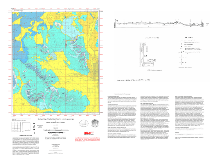
104°22'30"W 559000 560000 561000 104°20'0"W 562000 563000 564000 565000 104°17'30"W 566000 567000 568000 569000 570000 104°15'0"W 3596000 3596000 32°30'0"N 32°30'0"N 19 Qy 6 Qy Ptm Ptm Qo Qo 10 7 7 10 Pym Ptm Qy 8 3595000 Qo Qo 20 Pymg Qo Qy Qo Qo Ptm Qo Qo Ptm 19 3595000 9 7 15 Qy 20 12 Ptd 9 Ptm Pymg 9 3594000 5 28 26 12 Qa 38 15 26 Ptm Qo 8 Pym 8 3594000 Ptm Ptms 3 4 Qy Qy Qy 10 Pymg 38 38 5 Ptm Qy 4 5 Pymg 3593000 30 Pymg 16 3593000 4 4 11 20 11 12 6 3 3592000 Ptd Qy 3 18 9 Pymp 6 8 Ptd Pymp 22 6 10 32°27'30"N 3591000 Pymg Ptms Ptd Pymg Ptmp 6 3 Pymp Pymg Pymg 12 13 9 71 Ptms 14 51 Ptms 11 15 3590000 Pymp 6 7 3 3 10Ptd Ptmsg 17 6 5 Ptmsg 15 6 Pymp Ptmsg 6 Ptmsg 10 8 8 8 22 4 Ptd 32°27'30"N 3591000 Ptd 71 Ptd 9 Pymg 5 3589000 10 Qo 16 6 3 9 29 Ptd Ptd 22 3 Pymp 10 8 Pymg 3 12 Ptd 6 7 Ptd 5 8 6 Pymp 3592000 5 Pymp 6 14 8 Ptd 6 3 Pymp 3 3 Pym 3590000 Ptd 8 11 7 Ptd 9 12 32 Pymg 7 8 3 4 4 4 4 8 6 Pymp 16 5 Ptms 3589000 Pymp 5 3 Pym Ptd Ptms 4 Pym 3588000 Ptd 18 Qo 9 5 4 Pym 4 3588000 6 Ptd Pym Ptd Ptd Pym Ptd Pym 3587000 Ptd Ptm Pym Pym Ptd Pym PtdPym 3 7 Pym 17 32°25'0"N Ptd Ptms Qy 3 Ptd Ptd 3587000 18 Pymp Ptd Ptm Ptd 3 Ptd 32°25'0"N Pym Ptd Ptd Ptd Pymp Ptd Pymp Ptd Ptd 3586000 Ptd Qy Ptd Ptd 3586000 Pym Pymp Pymp Ptd Ptd Pym 8 Pymp Pymp Ptm Ptd Ptd Pym Ptms 3585000 Pym Ptd 3585000 Pymp Ptms Pym 8 Pymp Pymp Ptms Pymp Ptms Unit descriptions, Carlsbad West quadrangle Pym (Dehler mapping, 2002) version June 20th, 2002 Pymp Pym PymPtd Pym Ptd 3584000 Pymp Ptd Pymp Pymp Ptms Pymp Pymp Pymp Pymp PympPtd Ptm 3584000 Ptd Ptd Pymp Ptms Ptms Pymp Pymp Ptms Ptd Ptd Ptms Qo Ptms Ptms 3583000 Ptms Qy 3583000 Ptms 3 Qo Ptmp 3582000 32°22'30"N 559000 560000 104°22'30"W 561000 Base from U.S.Geological Survey 1984, from photographs taken 1976 and field checked in 1976. Map edited in 1984 1927 North American datum, UTM projection -- zone 13 1000- meter Universal Transverse Mercator grid, zone 13, shown in red Seven Rivers Azotea Peak Lake Mcmillan South Carlsbad West 562000 563000 Kitchen Cove 564000 104°20'0"W 565000 566000 567000 104°17'30"W 568000 569000 570000 by Carol M. Dehler and Joel L. Pederson Angel Draw Carlsbad East June 2002 Magnetic Declination July, 2003 9º 01' East At Map Center 1:24,000 0.25 0.5 1 1.5 2 Otis Kilometers 0 0.25 0.5 1 1.5 2 CONTOUR INTERVAL 20 FEET NATIONAL GEODETIC VERTICAL DATUM OF 1929 New Mexico Bureau of Geology New Mexico Tech 801 Leroy Place Socorro, NM 87801-4796 [505] 835-5420 http://geoinfo.nmt.edu This and other maps are available in PDF format from: http://geoinfo.nmt.edu/statemap or contact: NMBGMR Publications -- [505] 835-5410 NMBGMR Geologic Information Center -- [505] 835-5145 104°15'0"W Qo—Quaternary deposits, older Older alluvium and colluvium. The alluvium consists of exotic and locally-derived gravels and gravelly-sands of the paleo-Pecos River system and is thinly mantled by eolian sediment in much of the field area. Well to poorly indurated, poorly sorted gravel with sand-granule matrix. Clast sizes are cm-scale in diameter, subrounded to rounded, and consist of sandy carbonates, limestones, sandstones, volcanic rock, chert, and jasper. Smaller (< 1 cm diameter) angular clasts of jasper and carbonate are also present. The matrix consists of subangular to rounded, fine-grained sandstone to granules composed of quartz and chert. The deposit is crudely bedded, and, in places, channel forms (0.5-1m thick) are interbedded with green-to-red silty sandstone. Local imbrication indicates flow to the southwest. The colluvium flanks the toes of hillsides of the Hackberry and Ocotillo hills, and consists of angular to rounded clasts of locally derived carbonates, with patches of bedrock exposed. Thickness of hillslope deposits: 0-~20 feet (< 6 meters), thickness of alluvium: 0-80 ft (23 m). Note: There are no terrace tops associated with these alluvial gravels, and therefore, the alluvial deposits represent a minimum thickness and may not all be the same age. Ptms---Tansill Formation—mixed silty facies Mixed dolomite, sandy siltstone to claystone, and gypsum, that is siltier than Ptmsg and forms slopes. Caps bedrock hills (usually anticlines) throughout quadrangle and mapped based on change from ledgey Tansill to more slopey character of this unit. Dolomite: Cream color weathered, blue-gray fresh. Thin to medium bedded. Claystone to siltstone to local very-finelower sandstone: dominantly olive green, with gray to orange, claystone to mudstone with thin interbeds of siltstone and very fine sandstone. Sandstone is a quartz arenite, subangular to subrounded grains, well sorted, and carbonate, silica and hematite cemented. Contorted beds with very thin gypsum interbeds. Poorly exposed. Likely equivalent to Ocotillo Member of DeFord and Riggs (1941). Lateral facies of Ptmsg and Ptm. Thickness >10 feet (3 m). Geologic Map of the Carlsbad West 7.5 - minute quadrangle 0 Carnero Peak 32°22'30"N 3582000 Qy—Quaternary deposits, younger Youngest alluvium and colluvium in valley floors and flanking toes of hillsides, respectively. In valley floors, fine-grained deposits dominate, and are locally modified by eolian processes; local patches of exotic gravels are present near Pecos River. Locally derived gravels and fine-grained sediment mantle bedrock hillsides in patches and mimic slopes of local bedrock: the gravels are the product of colluvial processes and the fine grained sediments are the results of colluvial and eolian processes. Thickness of colluvium: 0-10 feet (< 3 meters), thickness of alluvium: 0->10 feet (3 m). Miles DRAFT NMBGMR OF-GM 59 Ptmsg---Tansill Formation—mixed silty gypsiferous facies Mixed dolomite, sandy siltstone, and gypsum. More gypsiferous, and siltstone is more red to yellow in color than Ptms. Commonly forms red soil with gypsum crystals. Facies change from Tms to Tmsg can be seen (especially on air photo) just east of NM Highway 524 on northwest side of Ocotillo Hills. Poorly exposed. Likely equivalent of Ocotillo Member of DeFord and Riggs (1941). Thickness unknown, but may be similar to Ptms (~3 m). Ptmp—Tansill Formation---pisolite facies Interbedded laminated, massive, and pisolitic-oolitic dolomites. Very similar to Pymp facies with a lesser siliciclastic component. Pisolites-oolites are yellowish-tan to reddish-tan to creamy white weathered, grey-tan fresh, and grains are mms to >6 cms. in diameter. Thinly to thickly bedded. Beds are tabular to lenticular and weather blocky. Small (cms thick)- and large (metersthick)-scale teepee structures present. Laminated and massive dolomites are yellow to grey weathered, light grey fresh, finely crystalline, silty to sandy, and can weather into vesicular and nonvesicular intervals, with vesicles defining bedding. Local intraclasts and coated grains. Cryptalgal laminations and evapomoldic porosity common. Low-angle crossbeds within thick beds present. Gastropods (replaced by silica) and bioturbation present locally. This facies becomes prevalent in the southern Hackberry Hills, and near the central eastern edge of the field area, south of the Avalon Hills. Forms alternating cliffs and ledges. Grades laterally into Ptd facies and Ptm facies. Thickness: up to ~150 feet (46 m). Ptm--- Tansill Formation—mixed facies Mixed dolomite, siltstone, and gypsum. Significanly less silty and gypsiferous than Ptms and Ptmsg, and forms ledges. Sandy to silty, sugary dolomite to dolomitic limestone, weathers white to light tan to light grey to yellow, fresh color is light tan to light-medium grey to green. Conchoidally fractures. Interbedded with calcareous grey-green shale and pink siltstone. Alternating intervals of nonvesicular and vesicular dolomite define bedding, as do recessed intervals where shale has weathered out. Intraclastic breccia, peloids, mudcracks, fine laminations, local coated grains and ripplemarks, and teepee structures present. Rare gastropods and ostracods. Horizontal burrows present east of Avalon Hills. Thin to medium beds of dolomite interbedded with gypsum: dolomite shows evapomoldic porosity. Evapomoldic porosity can be mm-3 cm in diameter, pores often coalesced to define bedding. Voids can be lined with calcite and siderite, and are often at the base of individual beds. Terra rosa locally. Mesoscale plunging folds common in this facies: gypsum deposits or caves are associated with anticlinal hinges. Sink holes common in this facies (as large as 10 m across and 6 m deep in NW part of field area). Secondary calcite veins locally. Fracture sets trend: E-W, and NW-SE. Unit forms red to yellow to tans soils. Contact with overlying Ptms or Ptmsg facies is gradational and grades laterally into Ptmp. Thickness >40 feet (12). Ptd—Tansill Formation---Dolomite facies Ledgy to cliffy dolomite at the base of the Tansill formation. Sugary dolomite to dolomitic limestone, tan to gray to light tan fresh, light gray to tan to creamy white weathered. Local pisoids and ooids. Planar to crinkly-laminated to massive. Possible mudcracks. Thin to medium tabular beds with undulose to planar bedding contacts. Bedding tabular and blocky. Evapomoldic porosity and “vesicular” weathering. Ostracods, and thrombolites (synoptic relief of 3-4 cm) present locally. Local solution breccia. Contact between Tansill Formation and Yates Formation is sharp and is defined by the change from underlying slopey sandstone/siltstone (of upper Yates Formation) to cliffy dolomite (Tansill Formation) (Motts, 1962). Local cave formation along contact. Contact with overlying Ptm facies is gradational. Becomes thicker in east and southern parts of quadrangle and changes into Ptmp, and changes to Ptm in the northwest part of quadrangle. Thickness: 0-40 feet (0-12 m). Pym---Yates Formation---mixed facies Mixed sandstone, local quartzite, and crinkly-laminated to massive dolomite. Medium-bedded sandstones interbedded with silty dolomite, dolomite, and dolomitic siltstone. Sugary dolomite is commonly yellow-tan fresh and weathered, and contains chert and iron concretions, intraclasts. Thin to thick beds. Cryptalgal to massive, and forms ledges. Finely crystalline dolomites form conchoidal fractures. Local coated grains, but fewer than in Ptmp. Local symmetrical ripplemarks, solution breccia, and pyrite crystals ( <2-3 cm in diameter) in some dolomites Sandstones are fined grained, well sorted, subangular to rounded quartz arenites and local quartzites, and are more indurated in this facies than in facies to the east and south. Sink holes and folds common. Forms red soils locally. Dominantly in WNW part of quadrangle. Contact with other Yates facies are gradational. Contact with overlying Ptd facies is sharp. Thickness, >50 feet (15 m). Pymg---Yates Formation—mixed gypsiferous facies Mixed sandstone, gypsum, siltstone, and laminated dolomite. Sandstone is fine-grained, subangular to subrounded, gray to yellow, dolomite to silica to hematite cemented, and is interbedded with gray shales and gray to yellow siltstones. Sandstone is massive in 1.5 m thick beds with local intraclasts. Shales and siltstones are pink-orange, gypsiferous, thinly bedded, locally organic-rich, and weather into badlands. Dolomites contain chert and iron concretions, local intraclasts, or can be massive and vesicular. Secondary gypsum deposits (remobilized into balls about .5 to 1.0 m in diameter) are found associated with thinly bedded dolomites. This facies is only present in the NW part of the quadrangle. Contacts with other Yates facies are gradational. Contact with overlying Ptd or Ptm is sharp or covered. Thickness: >50 feet (12 m). Pyp---Yates Formation---mixed pisolite and sandstone facies Mixed sandstone, pisolite-oolite, and laminated to massive dolomite. The sandstones are yellow to red to orange-yellow weathered, tan to olive green-tan with red flecks fresh (flecks may be pyrite weathered to hematite), fine-lower to very-fine-lower, well sorted, quartz arenites. Hematite, silica, and carbonate cemented. Local siltstone intervals < 0.5 m thick. Water escape structures, climbing ripples, and ripple-cross lamination, and local pedogenic features are present. Beds are lenticular to tabular with undulose contacts, and average bed thickness is 5 cm. Beds are internally massive with mottling common (bioturbation and/or soft sediment deformation). Sandstone intervals can be > 4 m thick. Siltstone is pink to green to gray, thinly bedded and laminated to massive. Sandstones and siltstones are dominantly friable and typically form slopes. The sandstone intervals are intimately interbedded with the pisolite intervals. The interbedded pisolites are light gray weathered and fresh, and dolomitic. Coated grains are up to 12 cm in dia. Internally, grains show radial or concentric fabric, many grains are composed of composite grains, and grains are generally associated with brecciated dolomite and aragonite cement. Coated grains show both reverse and normal grading. Pisolites are associated with teepee structures and can be in a > 5 m thick interval. Pisolites are interbedded with vesicular dolomites (medium to thinly bedded), siltstone, and sandstone. Contorted beds within this subfacies are locally truncated. Pisolitic-oolitic beds are tabular to lenticular. Massive to laminated dolomite, interbedded with the pisolites and sandstones and siltstones, are yellow, cryptalgal laminated with jelly roll structures, and local mudcracks and intraclasts. Local laminations of calcareous siltstone also present. Medium bedded, blocky, and tabular geometry. Good exposure of this facies in drainages on the south-central and central-eastern drainages of the Ocotillo Hills and southeastern side of Hackberry Hills. Contacts with other Yates facies are gradational. Contact with overlying Ptd is sharp. Thickness: > 100 feet (30.5 m) Pyu---Yates Formation---undifferentiated Undifferentiated Yates Formation deposits that underlie the Ymp facies in the Carlsbad West Quadrangle. This unit is shown on the cross section only. Thickness unknown, but estimated to be 100-200 feet (30-60 m), based on mapping by Motts (1962). References: De Ford, R.K., and Riggs, G.D., 1941. Tansill Formation, west Texas and southeastern New Mexico: AAPG Bulletin v. 25, no. 9, p. 1713-1728. Motts, W.S., 1962. Geology of the West Carlsbad Quadrangle, New Mexico. USGS GQ-167, scale 1:62, 500.


