Case Study 5 Rose River, Madison County, Virginia (210–VI–NEH, August 2007)
advertisement
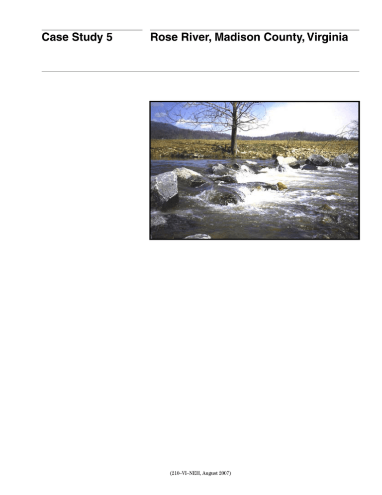
Case Study 5 Rose River, Madison County, Virginia (210–VI–NEH, August 2007) Case Study 5 Rose River, Madison County, Virginia Part 654 National Engineering Handbook Issued August 2007 Cover photo: Rock weir on the Rose River in Virginia Advisory Note Techniques and approaches contained in this handbook are not all-inclusive, nor universally applicable. Designing stream restorations requires appropriate training and experience, especially to identify conditions where various approaches, tools, and techniques are most applicable, as well as their limitations for design. Note also that product names are included only to show type and availability and do not constitute endorsement for their specific use. (210–VI–NEH, August 2007) Case Study 5 Rose River, Madison County, Virginia Alica J. Ketchem, P.E.; U.S. Department of Agriculture, Natural Resources Conservation Service, Richmond, Virginia Abstract In 1995 and 1996, major storm events caused severe damage to the Rose River in Madison County, Virginia. In 1998, 4,200 feet of the Rose River was restored to a more stable condition and strengthened using a variety of natural and ecologically friendly techniques. This effort included the installation of nine vortex rock weirs and two sets of rootwads. Five years after installation, during Hurricane Isabel, the Rose River flooded again. Although some of the weirs and rootwads were damaged by this flood, the majority of the site remained in a stable condition. History During the mid-1990s, central Virginia experienced three major floods. The June 1995 storm was a 500to 1,000-year frequency event. More than 30 inches of rain fell in 24 hours. Rain on top of 3 feet of snow produced a 25-year frequency event in January of 1996. In September 1996, Hurricane Fran produced 10.5 inches of rain for a greater than 100-year frequency storm. The Rose River, in Madison County near Syria, was severely damaged by these repeated events. In 1995 and again during the winter of 1998, the U.S. Department of Agriculture (USDA) Natural Resources Conservation Service (NRCS) used the Emergency Watershed Protection (EWP) program to restore the Rose River to its preevent hydrologic condition. In September 2003, Hurricane Isabel again flooded the site. Since this was a 5-year event with 4.10 inches of precipitation, there was less damage than in the previous storms. The project cooperators for the Rose River restoration were the NRCS, Virginia Department of Game and Inland Fisheries (DGIF), Virginia Department of Forestry (DOF), Virginia Department of Conservation and Recreation (DCR), and Graves Mountain Lodge Corporation. The U.S. Army Corps of Engineers (USACE) provided comments. Because this site was classified as a nonexigency after Hurricane Fran (September 1996), there was time to make detailed plans for this site. The work included removal of large sediment deposits along the channel and installation of nine vortex rock weirs, two sets of rootwad revetments, and 400 linear feet of riprap. The river was also rerouted back into its preflood location at the upper end. The overall cost of construction was approximately $120,000, or about $29 per linear foot. Goals The primary goal of the 1998 restoration was to restore the hydrologic function of the river. At the time of the initial assessment, the major problem with the upper third of the reach was a large cobble and debris bar that constricted the flood plain at the single lane bridge leading to several private residences. A 6- to 8-foot-high vertical bank existed along one driveway for a house at the very top of the reach. Between the time of the initial NRCS site visit and the time of final contract package preparation, the landowner did some work to protect the driveway. In the lower two-thirds of the reach, banks were 6 to 8 feet high and vertical in several places. The most serious eroded area was located at the bottom of the reach and was about 10 feet from State Road 670. This lower reach also had large cobble bars that were constricting the flood plain. Another goal for this restoration project was to address the concerns of the other stakeholders. The Virginia DGIF was very interested in this site because it was stocked with trout. It was also the site for an annual Children’s Fish-For-Fun event. This meant that the site needed to be safe. The landowner was concerned with water access for cattle and tractor crossings. He also wanted to protect the driveway that paralleled the river on the upper end of the reach. Comments from the USACE indicated that revegetation of the site was critical. These goals seemed to be reasonable and attainable. At the completion of the construction, the majority of these goals were met. The landowner used the Conservation Reserve Program (CRP) to exclude cattle from the site and to plant trees in the riparian zone. By this means, the site became well vegetated and stable. (210–VI–NEH, August 2007) CS5–1 Case Study 5 Rose River, Madison County, Virginia Part 654 National Engineering Handbook Description of the watershed geometry. However, relatively few changes were made to the channel location during construction. The site is located in Madison County, Virginia, in a mountainous section of the Virginia Piedmont region. The watershed is about 14 square miles and mostly wooded with some grassland agriculture along the river. Houses and small businesses are scattered throughout the area. Tourism is important to the economy of this area. The interagency team was primarily concerned with control of the vertical dimensions of the reach. The fisheries stakeholders were particularly interested in maintaining the big pool in the lower reach. Concern also focused on cobble removal from the river, which would result in instability of the channel grade. This issue was addressed through the use of nine vortex rock weirs. The watershed will continue to be impacted by results of the June 1995 storm for many years to come. This large, slow-moving storm dropped more than 30 inches of water along the east side of the Blue Ridge Mountain range. According to the U.S. Geological Survey (USGS), hundreds of rock slides occurred. This continual supply of cobbles and gravel, therefore, will be available to the river for the foreseeable future. Description of the reach This reach of the Rose River is about 4,200 linear feet long and runs parallel to State Route 670 for its entire length. A small bridge crosses the river about a third of the way down from the upper end. A private driveway extends along the river in both directions from the bridge. At the time of construction, the entire reach had only one landowner and was in pasture with unlimited cattle access. The bed was covered in cobbles with some sand accumulation in the pools. Some large boulders were scattered throughout. The water was very clear, even after a storm, and macroinvertebrates have been noted. Controls and assessment of risk The only hard control in the reach was at the bridge. The proximity of the river to the state road at the lower end and the driveway at the upper end required installation of riprap at each location. This created two new control points. For the remainder of the channel, there were no constraints on moving the channel laterally as needed to achieve a more stable meander CS5–2 The stream in its degraded condition posed several risks. If the restoration work was not performed, the state road would have been undercut through continued migration of the river. The private driveway at the upstream end of the bridge was also threatened, but could have been moved away from the river. The cutbanks would continue to erode, adding sediment load, and fish habitat would deteriorate due to filling of the pools or by loss of the pools from bed instability. Flooding would be more significant because of the large cobble and debris bars that constricted the channel. Repairing the reach also had risks. One risk that was beyond control was the possibility that there would be another large flood event. Landowners tend to expect stream restoration projects to function indefinitely. However, natural streams should be expected to move and evolve in response to large storms. In addition, very few stream structures or improvements have withstood the discharge of water associated with a hurricane or similar large storm. However, restoration of the hydrologic function of the river was considered worth the possibility of future damages. The use of rootwads for bank protection was less of a risk, given the cost of the treatment. Under rules of the EWP program, NRCS cannot protect agricultural land that is of less value than the cost of the protection. Rootwads are commonly available in the flood plain after a flood event and can be used to provide streambank protection for only the cost of installation. Few suitable rootwads were available on the Rose River; however, but an adjacent EWP contract had many rootwads and no place to put them. An arrangement was made for the disposal of rootwads and other (210–VI–NEH, August 2007) Case Study 5 Rose River, Madison County, Virginia woody debris on the Rose River site. The rootwads were used, and the other material was burned and buried. Vortex rock weirs posed more risk. The methodology was still new in Virginia, and previous installations had mixed results. As part of the agreement with the partnering agencies, NRCS installed nine weirs. Some of the rocks were provided by the DGIF, and some came from rock slides located on the property. Dominant processes The major process that has repeatedly affected the Rose River is the heavy flooding caused by large storms and hurricanes. Since the time of construction, several floods have occurred that were 1 to 2 feet deep on the flood plain. Few changes occurred in the channel from these small events. Hurricane Isabel, however, caused some obvious changes in channel elevations in at least two locations and damaged some of the rootwads and weirs. Design criteria/constraints The funding program requirement that the stream could not be made better than the preevent condition was a significant constraint on the design process. The goal is to restore hydrologic function, therefore, and not specifically to establish new features or create elements that did not exist. However, the features that were there before the flood can be restored. For this site, the design included maintenance of fish habitat and grade control, restoration of the flood plain capacity, and protection of the roads. Although not a primary goal, the overall safety of the site was improved by grading the vertical banks to a more stable slope. Data collected and analysis performed Prior to construction, the profile and cross sections of the reach were surveyed. The tops and bottoms of riffles and the centers of pools were located. From these Part 654 National Engineering Handbook data, the average grade of the reach and the intermediate grades of the riffles and pools were identified. The average channel gradient was less than 2 percent in the lower reach and in most of the upper reach. The upper reach had one riffle with a grade of about 4 percent. The proposed bankfull dimensions were identified from Leopold’s chart (Leopold 1994) that correlates drainage area with bankfull dimensions. Since no local regional curves existed at the time, Leopold’s curve for the eastern United States was used. These dimensions seemed to fit with the visual appearance of the site. The curves were used instead of onsite information because major flooding tends to remove most of the bankfull indicators. Figure CS5–1 shows complementary plan and profile survey information for Rose River for 1997 and 2004, after the severe storms. Rosgen’s Stream Classification System (Rosgen 1994) was used to describe the proposed restoration. For a bankfull width of 50 feet and an average depth of 3 feet, several geomorphic parameters were identified. The entrenchment ratio was to be greater than 2.2. This dimension could be achieved along most of the river by the removal of large cobble bars. A belt width of 200 feet and a sinuosity of 1.4 were also defined. A meander length of 500 feet and a radius of curvature of 100 to 115 feet were calculated. As a whole, very little of this plan view information was used because the river was left in the postflood location for the most part. At the upper section, where the river had been rerouted, the channel was restored to its original location. In the lower reach, the small braided channels through the cobble bar were pushed into the dominant channel. Achievement of the bankfull cross section and adjacent flood plain elevation was the primary use of the geomorphic information. Design and installation features The work started at the lower end of the reach with installation of riprap to protect the state road. To make it easier to key the rock into the channel, the contractor cut a diversion channel through the cobble bar that started above the riprap area and ended below the next riffle. Since the left bank of the river was too close to the road, the channel was moved to the right (210–VI–NEH, August 2007) CS5–3 Case Study 5 Rose River, Madison County, Virginia Part 654 National Engineering Handbook Figure CS5–1 Rose River profile and plan view survey information (shown in ft, as surveyed) for 1997 and 2004 0+00 100.0 3+00 6+00 9+00 12+00 15+00 18+00 21+00 Weir 9 Weir 8 80.0 Bridge Weir 7 Weir 6 Weir 5 Weir 4 60.0 Weir 1 Weir 3 Weir 2 40.0 20.0 21+00 24+00 27+00 Cobble bar Start of riprap End of riprap 30+00 33+00 36+00 0+00 1997 2004 Upper rootwads Weir 9 Weir 8 Channel cut by landowner Bridge Cobble bar Weir 7 Cobble bar Weir 6 Lower rootwads Weir 5 Weir 4 Large pool Weir 3 Start of riprap End riprap Weir 2 Cobble bar 42+00 CS5–4 39+00 Weir 1 (210–VI–NEH, August 2007) 42+00 Case Study 5 Rose River, Madison County, Virginia about 20 feet. Material from the cobble bar was moved across the river to fill against the vertical left bank. After a 2H:1V slope was established, the contractor placed Class III riprap on the bank and keyed it into the river bottom. About 200 linear feet of bank were armored. Before the water was redirected into the main channel, two vortex rock weirs were installed at the top and bottom of the riffle immediately downstream of the riprap. Each weir required about 60 tons of Class III rock. The rocks are about one cubic yard in size, resulting in 20 to 30 rocks on the bottom row and 20 to 30 rocks on the top row. The left end of each weir was keyed into natural ground. The right ends were buried in the cobble bar, but had no real anchor point. The bottom row of rocks was completely embedded in the river bottom in a horseshoe shape with the sides higher than the center. The top of the center top rock was also embedded, and it was to extend no more than 3 inches from the bottom of the riverbed. The remainder of the top rocks were nested into the spaces between the bottom rocks and gradually became less embedded as they approached the shore. Because the work was done in the dry channel, it was difficult to accurately determine the correct elevation of the center rock. When the water was returned to the main Figure CS5–2 Weir #5, March 1998, immediately after construction Part 654 National Engineering Handbook channel, it was determined that the rocks were higher than planned but still acceptable. After this work was completed, the water was redirected into the normal channel. The cobble bar was graded toward the right terrace to increase the entrenchment ratio. When the water was back in place, an abrupt change in the channel grade at the upstream end of the riprap was noticed. Another weir was installed “in the wet” to provide some grade control to correct this problem. By putting the track hoe in the water, the contractor was able to more accurately control the placement of the center rocks. Weir #3 was tied into natural ground on the left. As with weirs #1 and #2, the right end of this weir was buried into the cobble bar. The next section that was of major concern was at the large pool. This pool was about 150 feet long and 3 to 4 feet deep at the outside of the curve. The outside bank was 5 to 6 feet high and undercut. Because of the excellent trout habitat provided by the deep water, the DGIF staff was interested in maintaining the pool at the existing depth and location. To do this, one weir (#6) was placed at the head of the pool and one at the foot, at the top of the riffle (#5) (fig. CS5–2). A third weir (#4) was placed at the bottom of this riffle. The vertical bank was graded to a stable slope, and rootwads were trenched in along the pool (fig. CS5–3). At Figure CS5–3 (210–VI–NEH, August 2007) Lower rootwads, March 1998, immediately after construction CS5–5 Case Study 5 Rose River, Madison County, Virginia some time in the past, large slabs of concrete had been placed along the river. These were used as the footers for the first four or five rootwads. Large logs were used as footers for the remaining rootwads. Approximately 60 tons of Class III riprap was placed over the boles of the rootwads at the lower end of the set. These were covered by soil. A cobble bar constricted the flood plain between the large pool and the bridge. This material was graded toward the first terrace. The vertical bank at the edge of the terrace was graded to a stable slope with the cobble material. The river was cutting into the outside curve, in the meander between the bridge and the large pool, trying to cut a new channel. Since this new channel was approaching the lower driveway, the water was forced back into the preflood channel, and fill material was placed in the new channel. Several large rocks and a single rootwad were placed at the upper end of the fill material to provide some protection for the cobble material. Part 654 National Engineering Handbook was several feet deep and formed excellent fish habitat. In the upper reach, the river had been rerouted to protect the driveway. The initial survey showed that the slope between the stream cutoff and the driveway was about 4 percent in the original channel. Before the water was moved back into the original channel, weirs were installed at the top and bottom of this slope for grade control. Weir #8 was constructed at the bottom of the slope with large rocks that had been taken from one of the nearby rock slides. These rocks were flatter and more rounded than the Class III rocks used in the other weirs, but they were similar in weight. Weir #9 was installed at the top of the slope with 60 tons of Class III riprap. Weir #7 was located between the bridge and the curve. The left end was embedded into the cobble bar, and the right end was anchored into natural ground (fig. CS5–4). The scour hole that developed below this weir After the weirs were complete, the water was rerouted back into the original channel. The cut-through channel was blocked with large rootwads and cobble material from the large debris bar above the bridge (fig. CS5–5). The cobble material was trucked up the gully and dumped against the back of the rootwads. This made a very large plug of soil and rocks that would not be vulnerable to washing away if the river overtopped the rootwads. Fill was placed in the gully until the cobble bar material was removed to the bankfull elevation. The gully was then graded and shaped to a stable Figure CS5–4 Figure CS5–5 CS5–6 Weir #7, July 1998 (210–VI–NEH, August 2007) Upper rootwads after construction, July 1998 Case Study 5 Rose River, Madison County, Virginia slope. Lime, fertilizer, seed, and mulch were applied to the disturbed areas along the entire reach. Before the final payment was made to the contractor, the site experienced a small flood event. The channel above weir #9 had downcut to the elevation of the weir. Some of the top rocks were moved out of position. The top rocks in weir #8 also rolled out of position and moved downstream. The fill material between the upper rootwads was washed out, and large holes were created. The river also eroded against the bank at the driveway. At this time, the landowner requested that NRCS install riprap along the driveway to protect it. Although it was possible for the driveway to be moved, NRCS decided to install 200 linear feet of Class III riprap along the bank (fig. CS5–6). This was done to protect an old dump that was located under the road. This dump was exposed during Hurricane Fran and observed during the initial site visit. When the additional work was done, 60 tons of Class III riprap were placed in the holes behind the rootwads. The disturbed area was then regraded and replanted. No additional work was done to weirs #8 and #9. Part 654 National Engineering Handbook accumulation behind it. There were no repairs made to these weirs. Performance This site has been monitored visually for the past 7 years. Pictures taken annually showed little change from postconstruction in 1998 to April 2003 (figs. CS5–7 through CS5–11). This small flood also affected some of the other weirs in the reach. Most of the top rocks in weirs #1 and #6 were moved out of place. Weir #2 had some cobble The profile was again surveyed in April 2004 (fig. CS5–1). As could be expected, some sections were cut down, and some had filled in. The largest fill occurred at the beginning of the reach. The channel had filled in by about 7 feet in the section above the upper rootwads. It is unclear why this occurred. The profile also showed that weir #9 is providing grade control as planned. Where the river was turned back into its original channel, the profile shows the 2004 slope to be 3 to 4 feet lower than the 1997 profile. Some of this material was removed during construction. The riprap is stable and shows no signs of change. Below the riprap, the elevation of the channel bottom has not changed for about 400 linear feet. A deep pool has developed below the outlet of the gully cut by the landowner. The profile shows that the channel has filled in 2 to 3 feet for a distance of about 350 linear feet below Figure CS5–6 Figure CS5–7 Upper riprap, July 1998, 3 months after construction (210–VI–NEH, August 2007) Upper rootwads, April 2003 CS5–7 Case Study 5 Figure CS5–8 Figure CS5–10 CS5–8 Rose River, Madison County, Virginia Upper riprap, April 2003 Lower rootwads, April 2003 Figure CS5–9 Figure CS5–11 (210–VI–NEH, August 2007) Part 654 National Engineering Handbook Weir #7, April 2003 Weir #5, April 2003 Case Study 5 Rose River, Madison County, Virginia this point. There are few additional changes as the river approaches the bridge. After Hurricane Isabel (Sept. 2003), the section of the river immediately below the bridge filled in with about 3 feet of cobble material. Weir #7 was completely covered (fig. CS5–12). Only the rocks on the edges can still be seen. The pool has shifted downstream 50 to 60 feet. The riffle has become longer with no intermediate pools in the curve between weir #7 and weir #6, and weir #6 is unchanged. However, the lower set of rootwads has been almost totally removed. The bank is raw and nearly vertical again (fig. CS5–13). The large pool remains, held in place by weir #5 (fig. CS5–14). Part 654 National Engineering Handbook When the plan views were compared, they showed that most of the reach had only minor changes from 1997 (fig. CS5–1). The biggest change occurred below weir #8. Part of this probably occurred during construction, when the riprap was installed. However, the river has moved more to the right below the riprap, and the outside bank is vertical and unvegetated (fig. Figure CS5–13 Lower rootwads, April 2004, after Hurricane Isabel Figure CS5–14 Weir #5 and lower rootwads, April 2004, after Hurricane Isabel Weirs #5 and #4 appear to be unchanged. The drop in the channel grade from the 1997 survey occurred during construction in 1998. Very little channel work was done from weir #4 to weir #3. The survey shows that the river has experienced some fill and some degradation over about 500 linear feet. Based on the photographic record, the majority of this change occurred since April 2003. It is likely that most of it was done in Hurricane Isabel. Some fill also has occurred between weirs #3 and #2, along the riprap. A large pool has developed between weirs #2 and #1. Below weir #1, there seems to be little change in the channel grade. Figure CS5–12 Weir #7, April 2004, after Hurricane Isabel (210–VI–NEH, August 2007) CS5–9 Case Study 5 Rose River, Madison County, Virginia CS5–15). A large, fairly steep riffle has formed below this point. The second area where major changes occurred is in the curve between weirs #7 and #6. The curve seems to have become sharper, and some meander development has occurred. It is important to note that the landowner placed the entire reach into the CRP at the conclusion of construction. Planting grasses and trees and excluding the cattle from this area played a significant role in improving the long-term stability of the river. Part 654 National Engineering Handbook of this general observation. The upper rootwads were used as part of a gully plug to cut off the manmade channel. The material used behind this was primarily cobble with some purchased riprap. To date, there seems to be little or no deterioration in these rootwads (fig. CS5–16). One possible reason is that the flood plain elevation is at least 4 feet lower on the side across from the rootwads. Previous failures on other sites were because of overtopping. This has yet to occur on this site. By the time this contract started, the use of rootwads was an established technique in flood recovery in Virginia. The contractor used readily accessible material, which was an economical means to protect stream banks. Previous experience showed that rootwads that were trenched into an existing bank and backfilled were more stable than rootwads used to rebuild banks with only cobble material over them. The rootwads on the Rose River site performed completely opposite The lower rootwads were trenched into the bank with 10 to 15 feet of the bole embedded. Some of the rootwads at the upper end of this group are still in place. At the lower end, some of the rootwads are missing entirely, while others appear to have been snapped off. One possible explanation is that the flood plain became more entrenched immediately above the rootwads. Starting at the bridge, the right bank was 6 to 8 feet higher than the left bank. The excess cobble had been removed from the left bank to increase the width of the flood plain. Just below weir #6, the left bank intersected the first terrace. This constriction would have increased the flow velocity against the left bank and the rootwads along it. The water elevation may have been above the top of the rootwads, contributing to the problem. Figure CS5–15 Figure CS5–16 What features worked and what did not CS5–10 Raw bank downstream of riprap (210–VI–NEH, August 2007) Upper rootwads, April 2004, after Hurricane Isabel Case Study 5 Rose River, Madison County, Virginia As a whole, the use of vortex rock weirs made a significant contribution to the stability of this reach. Although not all of them have retained their original shape, the surveyed profile seems to indicate that they are all performing their grade control function. All of the weirs were still visible after Hurricane Isabel, except weir #7. It was almost completely buried in the bed. Prior to that event, only weir #2 had trapped a significant amount of bed-load material. From past experience, the top row of weir rocks need to be spaced one fourth to one-half of their diameter apart to reduce trapping. For this site, most of the top rocks were set about one-half of their diameter apart. Part 654 National Engineering Handbook ments will not last forever. Adequate vegetation and livestock exclusion will often contribute as much to stream stability as the installed structures. Successful stream restoration requires a vision of the big picture. The majority of the stream restoration work done in Virginia is done under the EWP program. Good interagency cooperation contributes to project success. By considering the needs and issues of interested parties, better design and better results can be achieved. However, a few things could be done to enhance performance. Weirs #1, #2, #8, and #9 were installed “in the dry.” Of these, only weir #2 has retained its function of grade control and flow direction. Weirs #3, #4, #5, #6, and #7 were installed without diverting the water. Of these, only the rocks in weirs #5 and #6 have shifted from their installed position. It was much easier to place the weirs at the desired elevation when the water was flowing. It is also easier to put them in the right place on the profile. For example, weir #9 should have been placed further upstream. After the first flood event, the river cut down to meet the weir. By placing the weir higher up, less change would have occurred in the channel in that area. The other main advantage of working “in the wet” is that it is viewed as being less disruptive to the stream ecology. It takes a full day to build a weir, if the water is diverted from the site. It only takes about 2 hours, if the equipment is allowed to work in the stream. Another change would be to use only angular rocks. The rocks used in weir #8 were native stone and did not interlock well. The top rocks rolled away in the first storm after installation. Overall lessons learned The primary lesson learned is that a successful restoration takes planning. However, time is restricted in a flood recovery situation, and possible shortcuts and solutions that can be used need to be identified fairly quickly. Rootwads and weirs are valuable tools for providing bank protection and grade control and are appropriate for many locations. However, these treat- (210–VI–NEH, August 2007) CS5–11

