Geography 1000
advertisement
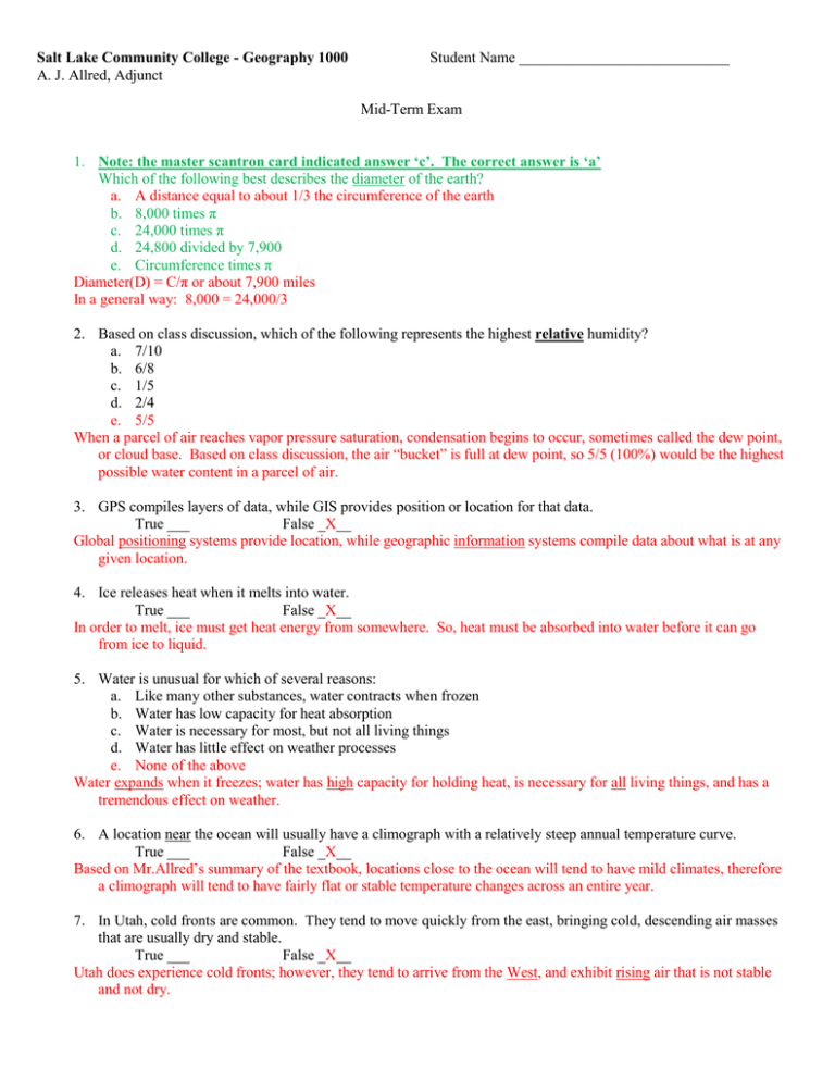
Salt Lake Community College - Geography 1000 A. J. Allred, Adjunct Student Name ____________________________ Mid-Term Exam 1. Note: the master scantron card indicated answer ‘c’. The correct answer is ‘a’ Which of the following best describes the diameter of the earth? a. A distance equal to about 1/3 the circumference of the earth b. 8,000 times π c. 24,000 times π d. 24,800 divided by 7,900 e. Circumference times π Diameter(D) = C/π or about 7,900 miles In a general way: 8,000 = 24,000/3 2. Based on class discussion, which of the following represents the highest relative humidity? a. 7/10 b. 6/8 c. 1/5 d. 2/4 e. 5/5 When a parcel of air reaches vapor pressure saturation, condensation begins to occur, sometimes called the dew point, or cloud base. Based on class discussion, the air “bucket” is full at dew point, so 5/5 (100%) would be the highest possible water content in a parcel of air. 3. GPS compiles layers of data, while GIS provides position or location for that data. True ___ False _X__ Global positioning systems provide location, while geographic information systems compile data about what is at any given location. 4. Ice releases heat when it melts into water. True ___ False _X__ In order to melt, ice must get heat energy from somewhere. So, heat must be absorbed into water before it can go from ice to liquid. 5. Water is unusual for which of several reasons: a. Like many other substances, water contracts when frozen b. Water has low capacity for heat absorption c. Water is necessary for most, but not all living things d. Water has little effect on weather processes e. None of the above Water expands when it freezes; water has high capacity for holding heat, is necessary for all living things, and has a tremendous effect on weather. 6. A location near the ocean will usually have a climograph with a relatively steep annual temperature curve. True ___ False _X__ Based on Mr.Allred’s summary of the textbook, locations close to the ocean will tend to have mild climates, therefore a climograph will tend to have fairly flat or stable temperature changes across an entire year. 7. In Utah, cold fronts are common. They tend to move quickly from the east, bringing cold, descending air masses that are usually dry and stable. True ___ False _X__ Utah does experience cold fronts; however, they tend to arrive from the West, and exhibit rising air that is not stable and not dry. 8. Atmospheric ozone is: a. air pollution produced by chlorofluorocarbons b. helps keep the surface of the earth warmer than otherwise c. is corrosive, poisonous and noxious d. b and c above e. a and c above Some ozone is made by humans, and is considered air pollution. Chlorofluorocarbons don’t produce ozone, they tend to destroy it. Atmospheric ozone is made by nature and captures solar ultraviolet, reducing Earth surface heating Any ozone, human or natural, is corrosive and poisonous. 9. Utah is dominated by which two general climate zones: a. A and B b. B and H c. C and D d. A and D e. A and C, with some E Utah is a dry region (B climate) and is mountainous (H climate). 10. The change in climate resulting from moving thousands of miles further north or further south of the equator may also be accomplished in a general way by moving closer to the coast of any ocean. True ___ False _X__ Moving away from the Equator will tend to make climate more severe. Moving closer to an ocean will tend to make climate more mild. 11. Hurricanes help ensure a relatively milder climate in equatorial regions and help prevent drought in many subtropical areas, including Florida. True _X__ False ___ Hurricanes are “heat engines” that store energy in water vapor. Tropical storms must move away from the Equator in order to turn into hurricanes. They carry heat as water vapor as they move north or south. The subtropics tend to be dry (B) climates, unless hurricanes and other storms bring them water. The southeast USA fits that category: it would be dry or even desert were it not for moisture delivered by tropical storms. 12. Which of the following options is/are represented by this generalized chemical relationship? [water + carbon dioxide + solar energy => fuel and oxygen] a. Creation of carbohydrate fuels b. Storage of sunshine and reduction of greenhouse gas c. A warmer planet than otherwise d. All of the above e. Only ‘a’ and ‘b’ above Storing energy as hydrocarbons removes that heat energy from the atmosphere, making things cooler. 13. Solar energy reaching the earth’s surface is reduced: a. when the earth is twice as far from the sun during winter months b. by ozone depletion c. by dust in the atmosphere d. all of the above e. none of the above The Earth’s orbit distance from the Sun varies only a little during the year. Ozone depletion would allow more solar energy to reach the surface (warmth), whereas dust would help screen out solar energy, helping keep the Earth’s surface cooler. 14. In Utah, what side of a mountain is more likely to be greener than the other options? a. Northwest b. Northeast c. Southeast d. Southwest Utah’s climate is typically dry, so the north-facing (shadier) side of the mountain should retain more moisture. At the same time, most storms arrive from the West, so western slopes should receive more precipitation than eastern sides. 15. The continental United States exhibits two kinds of ‘B’ climate and at least three kinds of ‘C’ climate. True _X__ False ___ Western US states are typically dry (either Bk-cold or Bh-hot). The west coast has two C climates (palm trees in California (Cs) and rainy forests in Oregon (Cf). Meanwhile, the entire southeast United States is a mild continental (Cw) climate, being warm and humid. 16. Citrus crops are found further north in Florida than in California because most of the U.S. southeast and gulf coasts are tropical ‘A’ climate zones. True ___ False _X__ Florida does have some tropical ‘A’ climate; however, icy winter weather from Canada can reach Florida at times, killing citrus in many areas. In contrast, southern California has a more stable interior climate that is less prone to winter frost so citrus crops can extend further north. 17. This month, Utah weather is dominated by: a. Regional high pressure that tends to promote dry conditions and desert b. Local daily surface heating that provokes rising air and some clouds c. Scattered small-scale rising air and instability d. All of the above e. None of the above - All year, Utah tends to be dry because of regional descending air masses (high pressure). - During summer, monsoon conditions bring wind from the south, sometimes including enough water to produce summer thunderstorms. - These thunderstorms arise from localized day time heating of landscapes, causing air to rise. Rising air eventually cools and condenses out water for precipitation and storminess. Because Utah is still pretty dry, these convective and frontal storms tend to be fairly scattered. 18. Which of the following lines follow “great circles” of the earth? a. the tropics of Cancer and Capricorn b. a typical line of latitude c. a typical, unadjusted time zone boundary d. the Arctic Circle (or Antarctic Circle) e. All of the above Time zones are lines of longitude or meridians. They run from pole to pole, which means that they each cover 180 degrees, or half the planet. Any line that would cut the Earth in half is a portion of a great circle. Even a short piece of string pulled straight on a round globe, would become a great circle if it were lengthened along the same line. 19. The earth’s atmosphere acts as a type of “blanket” that keeps electromagnetic energy out and also keeps it in. So, widespread volcanic activity could tip the balance between temporary atmospheric warming or temporary cooling and climate change. True _X__ False ___ The Earth’s balance of heating and cooling can easily be upset by a world-class volcano that deposits massive quantities of dust into the atmosphere. Aerosols (such as dust and water vapor) are like sun screen, helping reflect solar energy back into outer space. 20. The inter-tropical convergence zone (ITCZ) is related to: a. Masses of rising air and precipitation at about 30 degrees north and south latitudes b. Year-round rain in high latitudes c. Hurricanes and tornadoes at the equator d. All of the above e. None of the above There are no masses of rising air at 30 degrees north or south, but descending, drying air masses and deserts. There are no hurricanes or tornadoes at the Equator because tropical storms have to move north or south in order to pick up Coriolis spin and to find cool, dry air to push against. Year-round wet weather occurs at the Equator, not at high latitudes where cold air tends to be dry. Because of Hadley cells, masses of rising air tend to occur at the Equator. So, the tropics are wet from rising air, and the subtropics (30 degrees north and south) are dry from descending air 21. During a weather inversion: a. High mountain areas can be warmer than lower valleys b. Valley air quality is often poor c. There is relatively little chance of precipitation d. All of the above e. None of the above Normal weather is unstable, with warm air rising from valleys (during the day) while cool air descends from highland (at night). An inversion is a temporary reversal: air is stable, with cold air staying low because it is heavy, and warm air staying high, because it is lighter. Stable air tends to be stagnant, even dirty. Stable air typically does not move enough to promote precipitation. 22. A “frontal” or “wedge” weather pattern can occur any time cooler, drier air meets warmer, wetter air. True _X__ False ___ Frontal weather is sometimes violent, because warm, wet air can rise faster (more buoyant) when it is next to cooler (heavier) and drier (heavier) air that is less buoyant. 23. A region that spans nine time zones represents: a. A little more than a third of the earth’s circumference b. About nine hours at the Arctic Circle, or about 4.5 hours near the equator c. About 135 degrees of longitude, at all latitudes d. All of the above e. None of the above Each time zone represents one hour, at all latitudes north and south. Each time zone has 15 degrees or longitude, so 9 x 15 = 135 degrees Answer ‘b’ is wrong because the number of hours in a time zone is the same no matter what latitude or width of the zone 24. About half of the United States is characterized as: a. A, tropical b. B, dry c. H, highland d. D, continental severe e. C, Mediterranean The western USA is dry, except for rainy Northwest Oregon and Washington coasts. The southwestern portion is underneath the dry end of a Hadley cell. The northern portion is blocked by mountains that keep some moisture from getting into dry areas. 25. In North America, at about 45 degrees north latitude a city near the east coast of a continent will likely have a more severe climate than a city on the west coast of that continent. True _X__ False ___ At 40-45 North latitude, winds prevail from the West, so weather patterns tend to develop from the West. Coastal conditions on the west coast should be mild (near an ocean) whereas Maine and Vermont on the eastern side of the USA tend to receive weather that arrives from Chicago and Canada, which are both “Continental-Severe” (D) climates. 26. A change in the Sun’s output of electromagnetic energy can have the following effects: a. Long-term climate change b. Short-term weather changes c. Disruption of commercial electrical transmission and communication services. d. All of the above e. None of the above Variations in solar output can have very important effects on Earth climates. Solar flares and ‘sun spots’ can be severe enough to disrupt electrical circuits on Earth. 27. A climograph that shows a temperature curve with a substantial dip in the middle probably represents a climate: a. In the tropics b. In the northern hemisphere c. Somewhere in South America d. Somewhere along the Oregon coast e. none of the above In the southern hemisphere the days are longer and warmer during December and January, so their climographs will show a temperature dip that bottoms-out in June and July. 28. A climograph for a seaport near the Equator should show very small variations in monthly average temperature and precipitation. True _X__ False ___ According to Mr. Allred’s summary of the textbook, being near the Equator and near the ocean should produce a mild climate. As such, average temperature and precipitation will often be stable and consistent across time. 29. Wind tends to flow toward high pressure regions, and tends to flow away from low pressure areas, resulting in deserts located at the ITCZ. True ___ False _X__ High pressure, by definition, pushes out or away from its center. Dry, descending air will push outward as it reaches the ground. As it descends it gets compressed and tends to get warmer and drier. In contrast, low atmospheric pressure is moving in toward its center because it is going up, leaving room for higher pressure to move in. At the ITCZ, air is rising because of converging and convection. Rising air will exhibit lower atmospheric pressure. At the other end of a Hadley cell, air is descending and warming by compression as it descends. Dry, descending air will spread out as it reaches the ground. That is the classic high pressure pattern. 30. Many soils in Utah have a pH of about 8.0, and can be improved for farming by making them more acid. True _X__ False ___ Many Utah soils have a pH of about 8.0. The Great Salt Lake is even more alkaline at a pH of about 10.0. Adding fresh water (not salt water) to farm soil would tend to make things a bit more acid. Soil with relatively higher acidity is more likely to be farm productive, and water is necessary for crop growth either way. 31. Exhaust from Utah power plants can contribute to acid soil conditions in Ohio and Pennsylvania. True _X__ False ___ Exhaust from burning fossil fuel, such as coal and natural gas in power plants, includes oxides of nitrogen and sulfur, both of which are acidic. Utah winds blow toward the East, which is typically humid and too acidic already, making things worse. 32. Nitrogen is vital to producing hydrocarbon fuels but can be a nuisance when those fuels are oxidized. True _X__ False ___ Atmospheric nitrogen is rather inert (inactive), but is vital for green plant growth. When nitrogen is drawn into an engine it gets burned along with oxygen and fuel. If combustion temperatures are high, oxides of nitrogen are produced, creating air pollution that tends to be acidic and corrosive. 33. The islands of Great Britain have a milder climate than locations at the same latitude that are deep within large land masses. True _X__ False ___ The British Isles are as far north as parts of Canada and Siberia, but are kept relatively warmer by being surrounded by ocean water that contains heat. Some of that heat comes from the Gulf Stream that brings warm, tropical water from equatorial regions. 34. NOTE: This question was marked incorrectly on the master scantron. The main source of energy for electric lighting in this classroom is: a. from nature’s storage of ancient, stored solar electromagnetic energy b. not from nuclear power, photo-voltaic or wind power c. from fossilized remnants of old lake beds and swamps d. not from geothermal heat from the earth’s interior e. all of the above are true statements 35. Which of the following pairs of earth elements is coming out of fossil ‘storage’ and being blamed for alleged global warming? a. nitrogen and oxygen b. carbon and nitrogen c. hydrogen and oxygen d. carbon and hydrogen e. oxygen and carbon All of the elements above are involved in their own “cycles” - - however, fossil fuels are mainly composed of hydrogen and carbon. Burning fossil fuels moves carbon from rock storage into the atmosphere, making it easier for the atmosphere to retain radiation heat and contributes to global warming. 36. Which combination of nature’s elements is most associated with electricity generation? a. carbon and nitrogen b. nitrogen and sulfur c. hydrogen and sulfur d. oxygen and nitrogen e. hydrogen and carbon As with Question #34 above, most fuels (and food) are made from hydrogren-carbon compounds. 37. Which of the following is not true: a. Oxides of nitrogen are an incidental result of burning of fossil fuels at high temperatures b. Oxides are an essential part of the carbon cycle wherein solar energy is stored and then combusted later c. Riding a bicycle is no better for the environment than driving a car because both activities involve combustion, oxidation and production of greenhouse gases d. Natural decay of dead plants and animals produces air emissions similar to power plants e. Natural gas cars produce most some of the same types of ‘air pollution’ as do gasoline and diesel cars. All of the above statements are true, except for answer ‘c’ - - riding a bicycle requires only a small amount of carbohydrate energy. Driving a 7,000 pound car requires a lot of carbohydrate (hydrocarbon). 38. If ice floating on the ocean melts due to climate change, the result will be a rise in sea level. True ___ False _X__ Floating ice is already IN the ocean, so when it melts it just shrinks a little so that it no longer floats. Sea level does not change. In contrast, ice stored on land will make sea level rise if it melts and slides into the ocean. 39. World-wide, low latitude ocean water is becoming colder as icebergs break loose, drift away and melt. True ___ False _X__ Icebergs moving south never make it to equatorial areas. Instead, rising atmospheric temperatures are adding heat to ocean water. Ocean currents move that heat everywhere, even to theArctic. 40. Tropical regions near the Equator would be much hotter were it not for hurricanes and Hadley cells that tend to move heat away from where regions where solar energy collection is concentrated. True _X__ False ___ Hurricanes contain heat in the form of water vapor. Tropical storms that move away from the Equator carry their heat and moisture to drier, cooler regions further north or south. Storms also bring cloud cover that help keep tropical areas from getting too much heat from sunshine. 41. An increase in world average surface temperature: a. is more likely to be noticed in the Artic where ice is melting rapidly b. will mean more precipitation and much more evaporation in continental interiors c. will make relatively little difference in Arizona and in the Tropics d. All of the above e. None of the above Rapid changes in temperature are occurring in polar regions where white is giving way to dark as ice melts Meanwhile, more heat means precipitation, but even more evaporation, so many areas will get drier. Desert areas have nothing more to lose so global warming will have less effect on them Tropical areas will be shielded somewhat by more clouds being produced by more evaporation 42. A storm front that includes a “dry line” boundary can produce some of the world’s most dangerous weather. True _X__ False ___ Warm, humid air is already buoyant, and can rise even faster when it bumps into drier,cooler air nearby. The faster air rises, the more wind it provokes at the surface. 43. Which of the following combinations is most likely to produce a tornado associated with “dry line” conditions: a. 88°F and 55% humidity on one side and 96°F and 80% on the other side b. 60°F and 45% humidity on one side and 60°F and 65% humidity on the other side c. 40°F and 65% humidity on one side and 50°F and 45% humidity on the other side d. No combination above is different enough to provoke stormy conditions e. All of the above are substantial enough to produce violate weather Answer ‘a’ shows: - The highest overall temperatures - - so more energy for storminess - The biggest contrast in moisture between air masses, provoking more buoyancy and faster rising (violent) air. 44. Clouds are often flat on the bottom and rough on the top because: a. The cloud bottom represents the lowest altitude where the humidity “bucket” becomes full b. The cloud top shows were air is relatively drier and/or cooler than below c. Clouds often form when air rises to the point where water vapor condenses and becomes visible d. Air is rising e. All of the above A cloud in the sky shows where the air is too cool to keep water vapor hidden (latent). The base of the cloud is the dew point, or the altitude where vapor pressure is saturated (bucket is full). The top of the cloud shows where the bucket is not yet full - - water vapor is still hidden. 45. Lightning is caused by: a. Electrical charges that build-up when air moves b. Clouds acting as storage ‘batteries’ c. Differences in positive and negative electrical charges from cloud to cloud or between ground and sky. d. All of the above e. None of the above Rising air often involves ice formation, and ‘friction’ that creates static electricity that is stored in the cloud until a dart leader or other pathway opens for discharging the cloud ‘battery’ to the ground. 46. Humidity levels tend to go down at night because the air cools and loses some of its capacity to hold vapor pressure. True ___ False _X__ At night, air temperature tends to drop, and therefore so does the capacity of the air to hold moisture. Relative humidity (the fullness of the ‘bucket’) will rises if the air loses some of its capacity to hold moisture. 47. Oceans are becoming more acidic. One cause involves the release of carbon from storage in rocks. True _X__ False ___ In nature’s way, rocks are always releasing some of their stored carbon, which ends up in the ocean as mildly acid carbon compounds. Humans add to that effect by burning fossil fuels that also acidic contain carbon. Other oxides from combustion also tend to be acidic, and much of it ends up in the ocean. 48. Fog can be produced any time humid air encounters a surface that is cold enough to cause the air to reach its dew point, or vapor pressure saturation. Fog forms when the air ‘bucket’ is full. True _X__ False ___ Fog is just another form of ‘cloud’ that represents air that has reached its capacity to hold dissolved water. When condensation occurs, the cloud that forms is evidence that water is escaping from its latent, or hidden state in the air. 49. Storm “surge” in a hurricane includes all of the following except: a. high wind b. high waves c. heavy rainfall d. high atmospheric pressure e. low atmospheric pressure Violent storms are a function of rising air that represents low atmospheric pressure. 50. The term “Doppler radar” refers to: a. The detection of wind speed and direction by bouncing radio waves off water vapor in the air b. objects moving away from the radar set having ‘slower’ apparent radar returns than objects moving toward the radar c. efforts to identify tornadoes that are embedded or hidden inside heavy cloud cover d. All of the above e. None of the above Radar can bounce radio waves off water in the air. If air is spinning, raindrops will be spinning also, showing which way air is moving. A tornado will show dramatic, curving differences between air that is moving toward the radar and then away from the radar.
